


Modena Voting District, Iron County, Utah
About
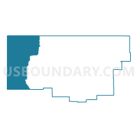
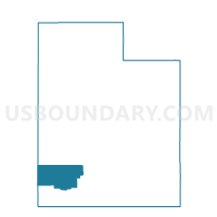
Outline

Summary
| Unique Area Identifier | 678891 |
| Name | Modena Voting District |
| County | Iron County |
| State | Utah |
| Area (square miles) | 635.00 |
| Land Area (square miles) | 634.93 |
| Water Area (square miles) | 0.06 |
| % of Land Area | 99.99 |
| % of Water Area | 0.01 |
| Latitude of the Internal Point | 37.96778680 |
| Longtitude of the Internal Point | -113.85759460 |
Maps

Graphs
Select a template below for downloading or customizing gragh for Modena Voting District, Iron County, Utah


Neighbors
Neighoring Voting District (by Name) Neighboring Voting District on the Map
- Beryl Voting District, Iron County, UT
- Enterprise #EN82.1 Voting District, Washington County, UT
- Milford 2 Unincorporated Voting District, Beaver County, UT
- Outside Cities and Towns #OUT2 Voting District, Washington County, UT
- Outside Enterprise City #EN82.2 Voting District, Washington County, UT
- Precinct 2 - Caliente, Lincoln County, NV
- Precinct 3 - Panaca, Lincoln County, NV
- Precinct 4 - Pioche, Lincoln County, NV
Top 10 Neighboring County Subdivision (by Population) Neighboring County Subdivision on the Map
- Pioche CCD, Lincoln County, NV (2,684)
- Milford-Minersville CCD, Beaver County, UT (2,678)
- Enterprise CCD, Washington County, UT (2,323)
- Beryl-Newcastle CCD, Iron County, UT (1,313)
Top 10 Neighboring Unified School District (by Population) Neighboring Unified School District on the Map
- Washington School District, UT (138,115)
- Iron School District, UT (46,163)
- Beaver School District, UT (6,629)
- Lincoln County School District, NV (5,345)
Top 10 Neighboring State Legislative District Lower Chamber (by Population) Neighboring State Legislative District Lower Chamber on the Map
- Assembly District 36, NV (59,012)
- State House District 74, UT (47,422)
- State House District 72, UT (40,624)
- State House District 73, UT (34,070)
Top 10 Neighboring State Legislative District Upper Chamber (by Population) Neighboring State Legislative District Upper Chamber on the Map
- State Senate District 29, UT (120,802)
- Rural Nevada Senatorial District, NV (97,335)
- State Senate District 28, UT (94,905)
Top 10 Neighboring 111th Congressional District (by Population) Neighboring 111th Congressional District on the Map
- Congressional District 3, UT (966,232)
- Congressional District 2, UT (890,993)
- Congressional District 2, NV (836,562)
Top 10 Neighboring Census Tract (by Population) Neighboring Census Tract on the Map
- Census Tract 1103, Iron County, UT (3,508)
- Census Tract 2702, Washington County, UT (3,074)
- Census Tract 1002, Beaver County, UT (2,811)
- Census Tract 9501, Lincoln County, NV (2,684)