


Voting District 0207, Waller County, Texas
About
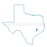
Outline

Summary
| Unique Area Identifier | 678012 |
| Name | Voting District 0207 |
| County | Waller County |
| State | Texas |
| Area (square miles) | 32.24 |
| Land Area (square miles) | 32.22 |
| Water Area (square miles) | 0.02 |
| % of Land Area | 99.95 |
| % of Water Area | 0.05 |
| Latitude of the Internal Point | 30.15803900 |
| Longtitude of the Internal Point | -95.83988230 |
Maps


Graphs
Select a template below for downloading or customizing gragh for Voting District 0207, Waller County, Texas


Neighbors
Neighoring Voting District (by Name) Neighboring Voting District on the Map
- Voting District 0004, Grimes County, TX
- Voting District 0014, Grimes County, TX
- Voting District 0018, Montgomery County, TX
- Voting District 0029, Montgomery County, TX
- Voting District 0030, Montgomery County, TX
- Voting District 0049, Harris County, TX
- Voting District 0065, Montgomery County, TX
- Voting District 0206, Waller County, TX
Top 10 Neighboring County Subdivision (by Population) Neighboring County Subdivision on the Map
- Northwest Harris CCD, Harris County, TX (651,299)
- Magnolia CCD, Montgomery County, TX (52,321)
- Montgomery CCD, Montgomery County, TX (50,994)
- Prairie View-Waller CCD, Waller County, TX (21,467)
- Navasota CCD, Grimes County, TX (17,995)
Top 10 Neighboring Unified School District (by Population) Neighboring Unified School District on the Map
- Magnolia Independent School District, TX (53,729)
- Waller Independent School District, TX (32,166)
- Navasota Independent School District, TX (19,326)
Top 10 Neighboring State Legislative District Lower Chamber (by Population) Neighboring State Legislative District Lower Chamber on the Map
- State House District 28, TX (263,682)
- State House District 130, TX (252,386)
- State House District 15, TX (222,505)
- State House District 13, TX (156,600)
Top 10 Neighboring State Legislative District Upper Chamber (by Population) Neighboring State Legislative District Upper Chamber on the Map
- State Senate District 7, TX (1,015,027)
- State Senate District 5, TX (899,155)
- State Senate District 18, TX (861,831)
- State Senate District 3, TX (818,359)
Top 10 Neighboring 111th Congressional District (by Population) Neighboring 111th Congressional District on the Map
- Congressional District 10, TX (981,367)
- Congressional District 8, TX (833,770)
- Congressional District 17, TX (760,042)
Top 10 Neighboring Census Tract (by Population) Neighboring Census Tract on the Map
- Census Tract 6901, Montgomery County, TX (9,909)
- Census Tract 6902.01, Montgomery County, TX (9,537)
- Census Tract 6806, Waller County, TX (7,907)
- Census Tract 5560, Harris County, TX (6,462)
- Census Tract 6946, Montgomery County, TX (6,405)
- Census Tract 6903, Montgomery County, TX (4,681)
- Census Tract 1801.02, Grimes County, TX (4,012)
Top 10 Neighboring 5-Digit ZIP Code Tabulation Area (by Population) Neighboring 5-Digit ZIP Code Tabulation Area on the Map
- 77354, TX (30,215)
- 77355, TX (24,010)
- 77316, TX (16,036)
- 77447, TX (11,872)
- 77484, TX (11,068)
- 77363, TX (3,269)