


Voting District 2029, Tarrant County, Texas
About
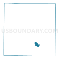
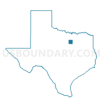
Outline

Summary
| Unique Area Identifier | 677200 |
| Name | Voting District 2029 |
| County | Tarrant County |
| State | Texas |
| Area (square miles) | 4.16 |
| Land Area (square miles) | 4.15 |
| Water Area (square miles) | 0.01 |
| % of Land Area | 99.75 |
| % of Water Area | 0.25 |
| Latitude of the Internal Point | 32.64800390 |
| Longtitude of the Internal Point | -97.21932080 |
Maps

Graphs
Select a template below for downloading or customizing gragh for Voting District 2029, Tarrant County, Texas


Neighbors
Neighoring Voting District (by Name) Neighboring Voting District on the Map
- Voting District 1184, Tarrant County, TX
- Voting District 1244, Tarrant County, TX
- Voting District 1293, Tarrant County, TX
- Voting District 1301, Tarrant County, TX
- Voting District 1515, Tarrant County, TX
- Voting District 1601, Tarrant County, TX
- Voting District 2219, Tarrant County, TX
- Voting District 2262, Tarrant County, TX
- Voting District 2305, Tarrant County, TX
- Voting District 2425, Tarrant County, TX
- Voting District 2522, Tarrant County, TX
Top 10 Neighboring County Subdivision (by Population) Neighboring County Subdivision on the Map
Top 10 Neighboring Place (by Population) Neighboring Place on the Map
- Fort Worth city, TX (741,206)
- Arlington city, TX (365,438)
- Forest Hill city, TX (12,355)
- Kennedale city, TX (6,763)
Top 10 Neighboring Unified School District (by Population) Neighboring Unified School District on the Map
- Fort Worth Independent School District, TX (466,910)
- Mansfield Independent School District, TX (138,558)
- Kennedale Independent School District, TX (17,898)
Top 10 Neighboring State Legislative District Lower Chamber (by Population) Neighboring State Legislative District Lower Chamber on the Map
- State House District 96, TX (231,782)
- State House District 95, TX (155,511)
- State House District 94, TX (143,509)
Top 10 Neighboring State Legislative District Upper Chamber (by Population) Neighboring State Legislative District Upper Chamber on the Map
Top 10 Neighboring 111th Congressional District (by Population) Neighboring 111th Congressional District on the Map
Top 10 Neighboring Census Tract (by Population) Neighboring Census Tract on the Map
- Census Tract 1114.04, Tarrant County, TX (8,336)
- Census Tract 1115.32, Tarrant County, TX (7,063)
- Census Tract 1216.09, Tarrant County, TX (6,056)
- Census Tract 1111.02, Tarrant County, TX (5,697)
- Census Tract 1060.04, Tarrant County, TX (5,273)
- Census Tract 1216.11, Tarrant County, TX (4,580)
- Census Tract 1111.03, Tarrant County, TX (3,968)
- Census Tract 1114.08, Tarrant County, TX (2,967)
- Census Tract 1114.05, Tarrant County, TX (2,356)
- Census Tract 1064, Tarrant County, TX (2,154)
Top 10 Neighboring 5-Digit ZIP Code Tabulation Area (by Population) Neighboring 5-Digit ZIP Code Tabulation Area on the Map
- 76017, TX (44,724)
- 76119, TX (42,761)
- 76016, TX (30,852)
- 76001, TX (30,460)
- 76140, TX (26,340)
- 76060, TX (6,764)