


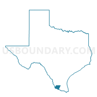
Voting District 0007, Starr County, Texas
About
Outline

Summary
| Unique Area Identifier | 676821 |
| Name | Voting District 0007 |
| County | Starr County |
| State | Texas |
| Area (square miles) | 75.63 |
| Land Area (square miles) | 72.81 |
| Water Area (square miles) | 2.82 |
| % of Land Area | 96.27 |
| % of Water Area | 3.73 |
| Latitude of the Internal Point | 26.57968590 |
| Longtitude of the Internal Point | -99.07193210 |
Maps


Graphs
Select a template below for downloading or customizing gragh for Voting District 0007, Starr County, Texas


Neighbors
Neighoring Voting District (by Name) Neighboring Voting District on the Map
- Voting District 0006, Starr County, TX
- Voting District 001A, Zapata County, TX
- Voting District 001B, Zapata County, TX
Top 10 Neighboring County Subdivision (by Population) Neighboring County Subdivision on the Map
Top 10 Neighboring Place (by Population) Neighboring Place on the Map
- Salineño CDP, TX (201)
- La Minita CDP, TX (171)
- Falconaire CDP, TX (132)
- Lago Vista CDP, TX (115)
- Salineño North CDP, TX (115)
- La Loma de Falcon CDP, TX (95)
- Los Arrieros CDP, TX (91)
- Falcon Heights CDP, TX (53)
- Indio CDP, TX (50)
- Chapeno CDP, TX (47)
Top 10 Neighboring Unified School District (by Population) Neighboring Unified School District on the Map
- Roma Independent School District, TX (23,556)
- Zapata County Independent School District, TX (14,018)