


Voting District 0002, Refugio County, Texas
About
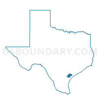
Outline

Summary
| Unique Area Identifier | 676539 |
| Name | Voting District 0002 |
| County | Refugio County |
| State | Texas |
| Area (square miles) | 110.91 |
| Land Area (square miles) | 110.76 |
| Water Area (square miles) | 0.16 |
| % of Land Area | 99.86 |
| % of Water Area | 0.14 |
| Latitude of the Internal Point | 28.20369730 |
| Longtitude of the Internal Point | -97.40888000 |
Maps


Graphs
Select a template below for downloading or customizing gragh for Voting District 0002, Refugio County, Texas


Neighbors
Neighoring Voting District (by Name) Neighboring Voting District on the Map
- Voting District 0001, Bee County, TX
- Voting District 0001, Refugio County, TX
- Voting District 0004, Bee County, TX
- Voting District 0006, San Patricio County, TX
- Voting District 0013, San Patricio County, TX
- Voting District 0014, San Patricio County, TX
- Voting District 001A, Refugio County, TX
- Voting District 002A, Refugio County, TX
- Voting District 003A, Refugio County, TX
Top 10 Neighboring County Subdivision (by Population) Neighboring County Subdivision on the Map
- Beeville CCD, Bee County, TX (27,429)
- Sinton-Odem CCD, San Patricio County, TX (14,109)
- Taft CCD, San Patricio County, TX (5,232)
- Refugio CCD, Refugio County, TX (3,699)
- Woodsboro CCD, Refugio County, TX (2,758)
- Skidmore CCD, Bee County, TX (2,430)
- Austwell-Tivoli CCD, Refugio County, TX (926)
Top 10 Neighboring Place (by Population) Neighboring Place on the Map
Top 10 Neighboring Unified School District (by Population) Neighboring Unified School District on the Map
- Beeville Independent School District, TX (26,742)
- Sinton Independent School District, TX (9,354)
- Refugio Independent School District, TX (3,919)
- Skidmore-Tynan Independent School District, TX (2,886)
- Woodsboro Independent School District, TX (2,757)
Top 10 Neighboring State Legislative District Lower Chamber (by Population) Neighboring State Legislative District Lower Chamber on the Map
- State House District 32, TX (157,055)
- State House District 35, TX (151,882)
- State House District 30, TX (147,611)
Top 10 Neighboring State Legislative District Upper Chamber (by Population) Neighboring State Legislative District Upper Chamber on the Map
Top 10 Neighboring 111th Congressional District (by Population) Neighboring 111th Congressional District on the Map
Top 10 Neighboring Census Tract (by Population) Neighboring Census Tract on the Map
- Census Tract 9502.01, Bee County, TX (7,928)
- Census Tract 109, San Patricio County, TX (4,580)
- Census Tract 9502, Refugio County, TX (3,699)
- Census Tract 9504, Refugio County, TX (3,684)
- Census Tract 107, San Patricio County, TX (3,663)
- Census Tract 9506, Bee County, TX (2,430)