


Voting District 0002, Jack County, Texas
About
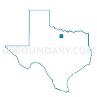
Outline

Summary
| Unique Area Identifier | 674953 |
| Name | Voting District 0002 |
| County | Jack County |
| State | Texas |
| Area (square miles) | 169.50 |
| Land Area (square miles) | 167.84 |
| Water Area (square miles) | 1.66 |
| % of Land Area | 99.02 |
| % of Water Area | 0.98 |
| Latitude of the Internal Point | 33.09322190 |
| Longtitude of the Internal Point | -98.02840550 |
Maps


Graphs
Select a template below for downloading or customizing gragh for Voting District 0002, Jack County, Texas


Neighbors
Neighoring Voting District (by Name) Neighboring Voting District on the Map
- Voting District 0001, Jack County, TX
- Voting District 0002, Palo Pinto County, TX
- Voting District 0003, Jack County, TX
- Voting District 0007, Palo Pinto County, TX
- Voting District 0015, Wise County, TX
- Voting District 0016, Wise County, TX
- Voting District 0210, Parker County, TX
- Voting District 0220, Parker County, TX
Top 10 Neighboring County Subdivision (by Population) Neighboring County Subdivision on the Map
- Bridgeport CCD, Wise County, TX (21,446)
- Weatherford Northwest CCD, Parker County, TX (13,782)
- Jacksboro CCD, Jack County, TX (6,217)
- Graford CCD, Palo Pinto County, TX (2,599)
- Perrin CCD, Jack County, TX (1,619)
Top 10 Neighboring Place (by Population) Neighboring Place on the Map
Top 10 Neighboring Unified School District (by Population) Neighboring Unified School District on the Map
- Bridgeport Independent School District, TX (12,063)
- Jacksboro Independent School District, TX (6,532)
- Poolville Independent School District, TX (2,968)
- Graford Independent School District, TX (2,323)
- Perrin-Whitt Consolidated Independent School District, TX (2,141)
Top 10 Neighboring State Legislative District Lower Chamber (by Population) Neighboring State Legislative District Lower Chamber on the Map
- State House District 61, TX (176,054)
- State House District 60, TX (148,990)
- State House District 68, TX (135,942)
Top 10 Neighboring State Legislative District Upper Chamber (by Population) Neighboring State Legislative District Upper Chamber on the Map
Top 10 Neighboring 111th Congressional District (by Population) Neighboring 111th Congressional District on the Map
Top 10 Neighboring Census Tract (by Population) Neighboring Census Tract on the Map
- Census Tract 1405.01, Parker County, TX (7,307)
- Census Tract 1405.02, Parker County, TX (6,475)
- Census Tract 1504.01, Wise County, TX (6,225)
- Census Tract 1504.02, Wise County, TX (5,514)
- Census Tract 9501, Jack County, TX (2,883)
- Census Tract 9505, Jack County, TX (2,827)
- Census Tract 1, Palo Pinto County, TX (2,599)