


Voting District 0400, Irion County, Texas
About
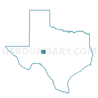
Outline

Summary
| Unique Area Identifier | 674951 |
| Name | Voting District 0400 |
| County | Irion County |
| State | Texas |
| Area (square miles) | 529.10 |
| Land Area (square miles) | 529.03 |
| Water Area (square miles) | 0.06 |
| % of Land Area | 99.99 |
| % of Water Area | 0.01 |
| Latitude of the Internal Point | 31.41361930 |
| Longtitude of the Internal Point | -100.98225150 |
Maps


Graphs
Select a template below for downloading or customizing gragh for Voting District 0400, Irion County, Texas


Neighbors
Neighoring Voting District (by Name) Neighboring Voting District on the Map
- Voting District 0002, Reagan County, TX
- Voting District 0003, Reagan County, TX
- Voting District 0100, Irion County, TX
- Voting District 0200, Irion County, TX
- Voting District 0301, Irion County, TX
- Voting District 0302, Irion County, TX
- Voting District 0318, Tom Green County, TX
- Voting District 0358, Tom Green County, TX
- Voting District 0423, Tom Green County, TX
Top 10 Neighboring County Subdivision (by Population) Neighboring County Subdivision on the Map
- West Tom Green CCD, Tom Green County, TX (25,405)
- Big Lake CCD, Reagan County, TX (3,367)
- Mertzon South CCD, Irion County, TX (1,484)
- Mertzon North CCD, Irion County, TX (115)
Top 10 Neighboring Place (by Population) Neighboring Place on the Map
Top 10 Neighboring Unified School District (by Population) Neighboring Unified School District on the Map
- San Angelo Independent School District, TX (94,460)
- Reagan County Independent School District, TX (3,367)
- Christoval Independent School District, TX (2,300)
- Water Valley Independent School District, TX (1,862)
- Irion County Independent School District, TX (1,599)
Top 10 Neighboring State Legislative District Lower Chamber (by Population) Neighboring State Legislative District Lower Chamber on the Map
Top 10 Neighboring State Legislative District Upper Chamber (by Population) Neighboring State Legislative District Upper Chamber on the Map
Top 10 Neighboring 111th Congressional District (by Population) Neighboring 111th Congressional District on the Map
Top 10 Neighboring Census Tract (by Population) Neighboring Census Tract on the Map
- Census Tract 17.04, Tom Green County, TX (7,661)
- Census Tract 9501, Reagan County, TX (3,367)
- Census Tract 9501, Irion County, TX (1,599)
Top 10 Neighboring 5-Digit ZIP Code Tabulation Area (by Population) Neighboring 5-Digit ZIP Code Tabulation Area on the Map
- 76904, TX (32,718)
- 76901, TX (27,969)
- 76932, TX (3,390)
- 76941, TX (1,348)
- 76958, TX (310)
- 76930, TX (156)