


Voting District 0002, Houston County, Texas
About
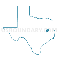
Outline

Summary
| Unique Area Identifier | 674850 |
| Name | Voting District 0002 |
| County | Houston County |
| State | Texas |
| Area (square miles) | 82.55 |
| Land Area (square miles) | 80.98 |
| Water Area (square miles) | 1.56 |
| % of Land Area | 98.10 |
| % of Water Area | 1.90 |
| Latitude of the Internal Point | 31.35199170 |
| Longtitude of the Internal Point | -95.55393930 |
Maps


Graphs
Select a template below for downloading or customizing gragh for Voting District 0002, Houston County, Texas


Neighbors
Neighoring Voting District (by Name) Neighboring Voting District on the Map
- Voting District 0001, Houston County, TX
- Voting District 0003, Houston County, TX
- Voting District 0004, Houston County, TX
- Voting District 0005, Houston County, TX
- Voting District 0006, Houston County, TX
- Voting District 0014, Houston County, TX
- Voting District 0014, Leon County, TX
- Voting District 0015, Houston County, TX
- Voting District 0022, Houston County, TX
Top 10 Neighboring County Subdivision (by Population) Neighboring County Subdivision on the Map
- Crockett CCD, Houston County, TX (10,831)
- Grapeland CCD, Houston County, TX (4,872)
- Centerville CCD, Leon County, TX (4,695)
- Porter Springs CCD, Houston County, TX (1,422)
Top 10 Neighboring Place (by Population) Neighboring Place on the Map
Top 10 Neighboring Unified School District (by Population) Neighboring Unified School District on the Map
- Crockett Independent School District, TX (9,477)
- Centerville Independent School District, TX (4,279)
- Grapeland Independent School District, TX (4,089)
- Latexo Independent School District, TX (2,307)
Top 10 Neighboring State Legislative District Lower Chamber (by Population) Neighboring State Legislative District Lower Chamber on the Map
Top 10 Neighboring State Legislative District Upper Chamber (by Population) Neighboring State Legislative District Upper Chamber on the Map
Top 10 Neighboring 111th Congressional District (by Population) Neighboring 111th Congressional District on the Map
Top 10 Neighboring Census Tract (by Population) Neighboring Census Tract on the Map
- Census Tract 9501, Houston County, TX (4,872)
- Census Tract 9503, Leon County, TX (4,695)
- Census Tract 9505, Houston County, TX (4,419)
- Census Tract 9503, Houston County, TX (3,274)
- Census Tract 9504, Houston County, TX (3,138)
- Census Tract 9502, Houston County, TX (1,422)