


Voting District 0005, Gaines County, Texas
About
Outline

Summary
| Unique Area Identifier | 673255 |
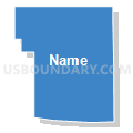
| Name | Voting District 0005 |
| County | Gaines County |
| State | Texas |
| Area (square miles) | 233.46 |
| Land Area (square miles) | 233.00 |
| Water Area (square miles) | 0.46 |
| % of Land Area | 99.80 |
| % of Water Area | 0.20 |
| Latitude of the Internal Point | 32.83637370 |
| Longtitude of the Internal Point | -102.32427880 |
Maps


Graphs
Select a template below for downloading or customizing gragh for Voting District 0005, Gaines County, Texas


Neighbors
Neighoring Voting District (by Name) Neighboring Voting District on the Map
- Voting District 0003, Dawson County, TX
- Voting District 0004, Dawson County, TX
- Voting District 0004, Gaines County, TX
- Voting District 0008, Gaines County, TX
- Voting District 0011, Dawson County, TX
- Voting District 01-1, Terry County, TX
- Voting District 04-5, Terry County, TX
Top 10 Neighboring County Subdivision (by Population) Neighboring County Subdivision on the Map
- Seminole CCD, Gaines County, TX (14,015)
- Brownfield CCD, Terry County, TX (11,648)
- Seagraves CCD, Gaines County, TX (3,511)
- Lamesa Northwest CCD, Dawson County, TX (422)
- Lamesa Southwest CCD, Dawson County, TX (405)
Top 10 Neighboring Place (by Population) Neighboring Place on the Map
Top 10 Neighboring Unified School District (by Population) Neighboring Unified School District on the Map
- Seminole Independent School District, TX (14,399)
- Seagraves Independent School District, TX (2,776)
- Klondike Independent School District, TX (721)
- Wellman-Union Consolidated Independent School District, TX (635)
- Loop Independent School District, TX (421)
- Dawson Independent School District, TX (398)
Top 10 Neighboring State Legislative District Lower Chamber (by Population) Neighboring State Legislative District Lower Chamber on the Map
- State House District 83, TX (173,230)
- State House District 82, TX (163,234)
- State House District 85, TX (143,267)
Top 10 Neighboring State Legislative District Upper Chamber (by Population) Neighboring State Legislative District Upper Chamber on the Map
Top 10 Neighboring 111th Congressional District (by Population) Neighboring 111th Congressional District on the Map
Top 10 Neighboring Census Tract (by Population) Neighboring Census Tract on the Map
- Census Tract 9502, Gaines County, TX (8,643)
- Census Tract 9501, Gaines County, TX (3,511)
- Census Tract 9501, Terry County, TX (2,510)
- Census Tract 9506, Dawson County, TX (1,835)
Top 10 Neighboring 5-Digit ZIP Code Tabulation Area (by Population) Neighboring 5-Digit ZIP Code Tabulation Area on the Map
- 79360, TX (13,574)
- 79331, TX (13,258)
- 79316, TX (11,451)
- 79359, TX (2,899)
- 79342, TX (352)
- 79377, TX (277)