


Voting District 0030, Erath County, Texas
About
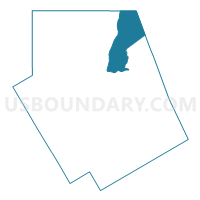
Outline

Summary
| Unique Area Identifier | 672990 |
| Name | Voting District 0030 |
| County | Erath County |
| State | Texas |
| Area (square miles) | 64.13 |
| Land Area (square miles) | 63.89 |
| Water Area (square miles) | 0.24 |
| % of Land Area | 99.63 |
| % of Water Area | 0.37 |
| Latitude of the Internal Point | 32.40890820 |
| Longtitude of the Internal Point | -98.11444300 |
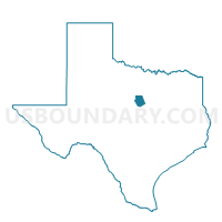
Maps

Graphs
Select a template below for downloading or customizing gragh for Voting District 0030, Erath County, Texas


Neighbors
Neighoring Voting District (by Name) Neighboring Voting District on the Map
- Voting District 0006, Hood County, TX
- Voting District 0007, Hood County, TX
- Voting District 0008, Palo Pinto County, TX
- Voting District 0032, Erath County, TX
- Voting District 0034, Erath County, TX
- Voting District 0041, Erath County, TX
- Voting District 0044, Erath County, TX
Top 10 Neighboring County Subdivision (by Population) Neighboring County Subdivision on the Map
- Stephenville CCD, Erath County, TX (26,491)
- Granbury West CCD, Hood County, TX (9,262)
- Palo Pinto-Santo CCD, Palo Pinto County, TX (3,777)
- Morgan Mill-Bluff Dale CCD, Erath County, TX (3,054)
Top 10 Neighboring Elementary School District (by Population) Neighboring Elementary School District on the Map
Top 10 Neighboring Secondary School District (by Population) Neighboring Secondary School District on the Map
Top 10 Neighboring Unified School District (by Population) Neighboring Unified School District on the Map
- Stephenville Independent School District, TX (24,507)
- Santo Independent School District, TX (3,201)
- Tolar Independent School District, TX (2,605)
- Lipan Independent School District, TX (1,943)
- Morgan Mill Independent School District, TX (929)
Top 10 Neighboring State Legislative District Lower Chamber (by Population) Neighboring State Legislative District Lower Chamber on the Map
Top 10 Neighboring State Legislative District Upper Chamber (by Population) Neighboring State Legislative District Upper Chamber on the Map
- State Senate District 30, TX (823,594)
- State Senate District 22, TX (789,412)
- State Senate District 24, TX (778,148)
Top 10 Neighboring 111th Congressional District (by Population) Neighboring 111th Congressional District on the Map
- Congressional District 31, TX (902,101)
- Congressional District 17, TX (760,042)
- Congressional District 13, TX (672,781)
Top 10 Neighboring Census Tract (by Population) Neighboring Census Tract on the Map
- Census Tract 1603.02, Hood County, TX (3,822)
- Census Tract 3, Palo Pinto County, TX (3,777)
- Census Tract 9502.01, Erath County, TX (3,455)
- Census Tract 9501, Erath County, TX (3,054)