


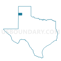
Voting District 0004, Deaf Smith County, Texas
About
Outline

Summary
| Unique Area Identifier | 672532 |
| Name | Voting District 0004 |
| County | Deaf Smith County |
| State | Texas |
| Area (square miles) | 578.75 |
| Land Area (square miles) | 578.21 |
| Water Area (square miles) | 0.54 |
| % of Land Area | 99.91 |
| % of Water Area | 0.09 |
| Latitude of the Internal Point | 35.09797430 |
| Longtitude of the Internal Point | -102.57042110 |
Maps


Graphs
Select a template below for downloading or customizing gragh for Voting District 0004, Deaf Smith County, Texas


Neighbors
Neighoring Voting District (by Name) Neighboring Voting District on the Map
- Voting District 0001, Deaf Smith County, TX
- Voting District 0002, Deaf Smith County, TX
- Voting District 0003, Deaf Smith County, TX
- Voting District 0202, Oldham County, TX
- Voting District 0203, Oldham County, TX
- Voting District 0208, Randall County, TX
- Voting District 0304, Randall County, TX
- Voting District 0321, Potter County, TX
- Voting District 0332, Randall County, TX
- Voting District 0403, Oldham County, TX
- Voting District 0404, Oldham County, TX
- Quay County Precinct 3, Quay County, NM
Top 10 Neighboring County Subdivision (by Population) Neighboring County Subdivision on the Map
- Amarillo CCD, Randall County, TX (104,938)
- Hereford East CCD, Deaf Smith County, TX (18,550)
- Canyon CCD, Randall County, TX (15,787)
- Canadian River Breaks CCD, Potter County, TX (5,266)
- Vega CCD, Oldham County, TX (1,812)
- Hereford West CCD, Deaf Smith County, TX (822)
- San Jon CCD, Quay County, NM (479)
- Adrian CCD, Oldham County, TX (240)
Top 10 Neighboring Place (by Population) Neighboring Place on the Map
Top 10 Neighboring Unified School District (by Population) Neighboring Unified School District on the Map
- Canyon Independent School District, TX (51,224)
- Hereford Independent School District, TX (19,135)
- Bushland Independent School District, TX (5,269)
- Vega Independent School District, TX (1,156)
- San Jon Municipal Schools, NM (476)
- Wildorado Independent School District, TX (349)
- Adrian Independent School District, TX (277)
- Walcott Independent School District, TX (143)
Top 10 Neighboring State Legislative District Lower Chamber (by Population) Neighboring State Legislative District Lower Chamber on the Map
- State House District 86, TX (154,914)
- State House District 87, TX (152,193)
- State House District 67, NM (25,041)
Top 10 Neighboring State Legislative District Upper Chamber (by Population) Neighboring State Legislative District Upper Chamber on the Map
Top 10 Neighboring 111th Congressional District (by Population) Neighboring 111th Congressional District on the Map
- Congressional District 19, TX (698,137)
- Congressional District 3, NM (693,284)
- Congressional District 13, TX (672,781)
Top 10 Neighboring Census Tract (by Population) Neighboring Census Tract on the Map
- Census Tract 217.04, Randall County, TX (6,988)
- Census Tract 9503, Deaf Smith County, TX (5,854)
- Census Tract 9504, Deaf Smith County, TX (5,695)
- Census Tract 143, Potter County, TX (5,266)
- Census Tract 219, Randall County, TX (4,125)
- Census Tract 9505, Deaf Smith County, TX (3,981)
- Census Tract 9506, Deaf Smith County, TX (3,842)
- Census Tract 9589, Quay County, NM (3,018)
- Census Tract 9501, Oldham County, TX (2,052)
Top 10 Neighboring 5-Digit ZIP Code Tabulation Area (by Population) Neighboring 5-Digit ZIP Code Tabulation Area on the Map
- 79045, TX (19,473)
- 79015, TX (19,277)
- 79092, TX (1,106)
- 79098, TX (517)
- 79001, TX (249)
- 88411, NM (82)