


Voting District 0010, Clay County, Texas
About
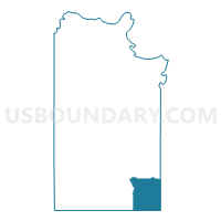
Outline

Summary
| Unique Area Identifier | 671490 |
| Name | Voting District 0010 |
| County | Clay County |
| State | Texas |
| Area (square miles) | 49.85 |
| Land Area (square miles) | 49.38 |
| Water Area (square miles) | 0.47 |
| % of Land Area | 99.06 |
| % of Water Area | 0.94 |
| Latitude of the Internal Point | 33.52266530 |
| Longtitude of the Internal Point | -98.03923570 |
Maps


Graphs
Select a template below for downloading or customizing gragh for Voting District 0010, Clay County, Texas


Neighbors
Neighoring Voting District (by Name) Neighboring Voting District on the Map
- Voting District 0001, Jack County, TX
- Voting District 0002, Montague County, TX
- Voting District 0024, Clay County, TX
- Voting District 0026, Clay County, TX
Top 10 Neighboring County Subdivision (by Population) Neighboring County Subdivision on the Map
- Bowie CCD, Montague County, TX (10,520)
- Jacksboro CCD, Jack County, TX (6,217)
- Bellevue-Joy CCD, Clay County, TX (1,685)
Top 10 Neighboring Unified School District (by Population) Neighboring Unified School District on the Map
- Bowie Independent School District, TX (10,466)
- Bellevue Independent School District, TX (830)
- Midway Independent School District, TX (783)
Top 10 Neighboring State Legislative District Lower Chamber (by Population) Neighboring State Legislative District Lower Chamber on the Map
Top 10 Neighboring State Legislative District Upper Chamber (by Population) Neighboring State Legislative District Upper Chamber on the Map
Top 10 Neighboring 111th Congressional District (by Population) Neighboring 111th Congressional District on the Map
Top 10 Neighboring Census Tract (by Population) Neighboring Census Tract on the Map
- Census Tract 9504, Montague County, TX (5,108)
- Census Tract 9501, Jack County, TX (2,883)
- Census Tract 303.02, Clay County, TX (2,819)