


Voting District 0027, Clay County, Texas
About
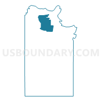
Outline

Summary
| Unique Area Identifier | 671484 |
| Name | Voting District 0027 |
| County | Clay County |
| State | Texas |
| Area (square miles) | 45.46 |
| Land Area (square miles) | 45.18 |
| Water Area (square miles) | 0.29 |
| % of Land Area | 99.37 |
| % of Water Area | 0.63 |
| Latitude of the Internal Point | 34.02026700 |
| Longtitude of the Internal Point | -98.23231180 |
Maps


Graphs
Select a template below for downloading or customizing gragh for Voting District 0027, Clay County, Texas


Neighbors
Neighoring Voting District (by Name) Neighboring Voting District on the Map
- Voting District 0006, Clay County, TX
- Voting District 0008, Clay County, TX
- Voting District 0009, Clay County, TX
- Voting District 0011, Clay County, TX
- Voting District 0014, Clay County, TX
Top 10 Neighboring County Subdivision (by Population) Neighboring County Subdivision on the Map
Top 10 Neighboring Place (by Population) Neighboring Place on the Map
Top 10 Neighboring Unified School District (by Population) Neighboring Unified School District on the Map
- Henrietta Independent School District, TX (5,771)
- Petrolia Independent School District, TX (2,157)
- Byers Independent School District, TX (717)