


Voting District 0011, Cherokee County, Texas
About
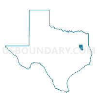
Outline

Summary
| Unique Area Identifier | 671448 |
| Name | Voting District 0011 |
| County | Cherokee County |
| State | Texas |
| Area (square miles) | 79.11 |
| Land Area (square miles) | 79.09 |
| Water Area (square miles) | 0.02 |
| % of Land Area | 99.97 |
| % of Water Area | 0.03 |
| Latitude of the Internal Point | 31.80562020 |
| Longtitude of the Internal Point | -95.03963910 |
Maps


Graphs
Select a template below for downloading or customizing gragh for Voting District 0011, Cherokee County, Texas


Neighbors
Neighoring Voting District (by Name) Neighboring Voting District on the Map
- Voting District 0010, Cherokee County, TX
- Voting District 0011, Nacogdoches County, TX
- Voting District 0012, Cherokee County, TX
- Voting District 0023, Cherokee County, TX
- Voting District 0024, Cherokee County, TX
- Voting District 0026, Cherokee County, TX
- Voting District 0047, Cherokee County, TX
- Voting District 0418, Rusk County, TX
Top 10 Neighboring County Subdivision (by Population) Neighboring County Subdivision on the Map
- Rusk CCD, Cherokee County, TX (12,789)
- Cushing-Douglass CCD, Nacogdoches County, TX (4,875)
- New Summerfield CCD, Cherokee County, TX (4,443)
- Alto CCD, Cherokee County, TX (3,541)
- Laneville CCD, Rusk County, TX (2,799)
Top 10 Neighboring Place (by Population) Neighboring Place on the Map
Top 10 Neighboring Unified School District (by Population) Neighboring Unified School District on the Map
- Rusk Independent School District, TX (12,208)
- Alto Independent School District, TX (3,642)
- Cushing Independent School District, TX (2,932)
Top 10 Neighboring State Legislative District Lower Chamber (by Population) Neighboring State Legislative District Lower Chamber on the Map
Top 10 Neighboring State Legislative District Upper Chamber (by Population) Neighboring State Legislative District Upper Chamber on the Map
Top 10 Neighboring 111th Congressional District (by Population) Neighboring 111th Congressional District on the Map
Top 10 Neighboring Census Tract (by Population) Neighboring Census Tract on the Map
- Census Tract 9502, Nacogdoches County, TX (4,875)
- Census Tract 9501, Cherokee County, TX (4,443)
- Census Tract 9508.01, Cherokee County, TX (4,408)
- Census Tract 9509, Cherokee County, TX (4,332)
- Census Tract 9510, Cherokee County, TX (3,541)
- Census Tract 9511, Rusk County, TX (2,799)
Top 10 Neighboring 5-Digit ZIP Code Tabulation Area (by Population) Neighboring 5-Digit ZIP Code Tabulation Area on the Map
- 75766, TX (26,388)
- 75785, TX (11,263)
- 75925, TX (4,179)
- 75760, TX (2,614)
- 75784, TX (658)
- 75788, TX (126)