


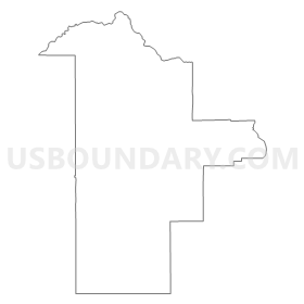
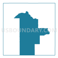
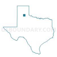
Voting District 0001, Briscoe County, Texas
About
Outline
Summary
| Unique Area Identifier | 671168 |
| Name | Voting District 0001 |
| County | Briscoe County |
| State | Texas |
| Area (square miles) | 263.49 |
| Land Area (square miles) | 263.46 |
| Water Area (square miles) | 0.03 |
| % of Land Area | 99.99 |
| % of Water Area | 0.01 |
| Latitude of the Internal Point | 34.49295340 |
| Longtitude of the Internal Point | -101.20389530 |
Maps

Graphs
Select a template below for downloading or customizing gragh for Voting District 0001, Briscoe County, Texas


Neighbors
Neighoring Voting District (by Name) Neighboring Voting District on the Map
- Voting District 0002, Briscoe County, TX
- Voting District 0003, Briscoe County, TX
- Voting District 0004, Briscoe County, TX
- Voting District 0009, Floyd County, TX
Top 10 Neighboring County Subdivision (by Population) Neighboring County Subdivision on the Map
- Lockney CCD, Floyd County, TX (2,622)
- Silverton CCD, Briscoe County, TX (1,102)
- Quitaque CCD, Briscoe County, TX (535)
Top 10 Neighboring Place (by Population) Neighboring Place on the Map
Top 10 Neighboring Unified School District (by Population) Neighboring Unified School District on the Map
- Floydada Independent School District, TX (3,955)
- Clarendon Independent School District, TX (3,187)
- Lockney Independent School District, TX (2,405)
- Silverton Independent School District, TX (1,100)
- Turkey-Quitaque Independent School District, TX (1,062)