


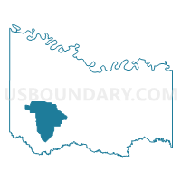
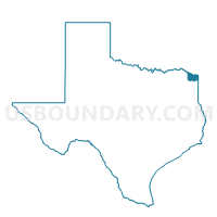
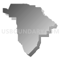
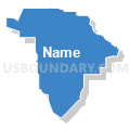
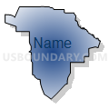
Voting District 0028, Bowie County, Texas
About
Outline

Summary
| Unique Area Identifier | 671002 |
| Name | Voting District 0028 |
| County | Bowie County |
| State | Texas |
| Area (square miles) | 52.00 |
| Land Area (square miles) | 51.89 |
| Water Area (square miles) | 0.11 |
| % of Land Area | 99.78 |
| % of Water Area | 0.22 |
| Latitude of the Internal Point | 33.37302700 |
| Longtitude of the Internal Point | -94.58250960 |
Maps

Graphs
Select a template below for downloading or customizing gragh for Voting District 0028, Bowie County, Texas


Neighbors
Neighoring Voting District (by Name) Neighboring Voting District on the Map
- Voting District 0018, Bowie County, TX
- Voting District 0019, Bowie County, TX
- Voting District 0024, Bowie County, TX
- Voting District 0025, Bowie County, TX
- Voting District 0027, Bowie County, TX
- Voting District 0029, Bowie County, TX
Top 10 Neighboring County Subdivision (by Population) Neighboring County Subdivision on the Map
- New Boston CCD, Bowie County, TX (10,820)
- De Kalb CCD, Bowie County, TX (5,238)
- Dalby Springs-Simms CCD, Bowie County, TX (2,455)
Top 10 Neighboring Unified School District (by Population) Neighboring Unified School District on the Map
- Simms Independent School District, TX (5,689)
- DeKalb Independent School District, TX (4,580)
- Hubbard Independent School District, TX (559)
Top 10 Neighboring State Legislative District Lower Chamber (by Population) Neighboring State Legislative District Lower Chamber on the Map
Top 10 Neighboring State Legislative District Upper Chamber (by Population) Neighboring State Legislative District Upper Chamber on the Map
Top 10 Neighboring 111th Congressional District (by Population) Neighboring 111th Congressional District on the Map
Top 10 Neighboring Census Tract (by Population) Neighboring Census Tract on the Map
- Census Tract 115.01, Bowie County, TX (7,910)
- Census Tract 116, Bowie County, TX (5,238)
- Census Tract 117, Bowie County, TX (2,455)