


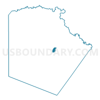
Voting District 4040, Bexar County, Texas
About
Outline

Summary
| Unique Area Identifier | 670594 |
| Name | Voting District 4040 |
| County | Bexar County |
| State | Texas |
| Area (square miles) | 2.40 |
| Land Area (square miles) | 2.39 |
| Water Area (square miles) | 0.01 |
| % of Land Area | 99.72 |
| % of Water Area | 0.28 |
| Latitude of the Internal Point | 29.44006500 |
| Longtitude of the Internal Point | -98.42997840 |
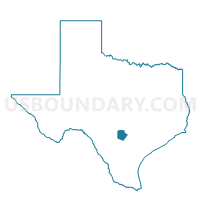
Maps

Graphs
Select a template below for downloading or customizing gragh for Voting District 4040, Bexar County, Texas


Neighbors
Neighoring Voting District (by Name) Neighboring Voting District on the Map
- Voting District 4007, Bexar County, TX
- Voting District 4009, Bexar County, TX
- Voting District 4010, Bexar County, TX
- Voting District 4011, Bexar County, TX
- Voting District 4039, Bexar County, TX
- Voting District 4041, Bexar County, TX
- Voting District 4043, Bexar County, TX
- Voting District 4082, Bexar County, TX
- Voting District 4106, Bexar County, TX
- Voting District 4135, Bexar County, TX
- Voting District 4186, Bexar County, TX
Top 10 Neighboring County Subdivision (by Population) Neighboring County Subdivision on the Map
Top 10 Neighboring Place (by Population) Neighboring Place on the Map
Top 10 Neighboring Unified School District (by Population) Neighboring Unified School District on the Map
- San Antonio Independent School District, TX (307,591)
- Judson Independent School District, TX (113,801)
- Fort Sam Houston Independent School District, TX (7,129)
Top 10 Neighboring State Legislative District Lower Chamber (by Population) Neighboring State Legislative District Lower Chamber on the Map
Top 10 Neighboring State Legislative District Upper Chamber (by Population) Neighboring State Legislative District Upper Chamber on the Map
- State Senate District 19, TX (766,044)
- State Senate District 21, TX (752,602)
- State Senate District 26, TX (721,704)
Top 10 Neighboring 111th Congressional District (by Population) Neighboring 111th Congressional District on the Map
Top 10 Neighboring Census Tract (by Population) Neighboring Census Tract on the Map
- Census Tract 1205.01, Bexar County, TX (8,151)
- Census Tract 1201, Bexar County, TX (7,129)
- Census Tract 1310, Bexar County, TX (5,066)
- Census Tract 1308, Bexar County, TX (4,848)
- Census Tract 1309, Bexar County, TX (4,689)
- Census Tract 1306, Bexar County, TX (4,595)
- Census Tract 1305, Bexar County, TX (4,146)
- Census Tract 1307, Bexar County, TX (1,728)
Top 10 Neighboring 5-Digit ZIP Code Tabulation Area (by Population) Neighboring 5-Digit ZIP Code Tabulation Area on the Map
- 78218, TX (31,917)
- 78220, TX (15,965)
- 78219, TX (15,225)
- 78202, TX (11,691)
- 78234, TX (7,126)
- 78208, TX (3,736)