


7 Voting District, Montgomery County, Tennessee
About
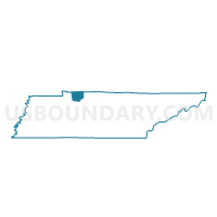
Outline

Summary
| Unique Area Identifier | 669280 |
| Name | 7 Voting District |
| County | Montgomery County |
| State | Tennessee |
| Area (square miles) | 66.39 |
| Land Area (square miles) | 65.75 |
| Water Area (square miles) | 0.64 |
| % of Land Area | 99.03 |
| % of Water Area | 0.97 |
| Latitude of the Internal Point | 36.49407480 |
| Longtitude of the Internal Point | -87.52965350 |
Maps


Graphs
Select a template below for downloading or customizing gragh for 7 Voting District, Montgomery County, Tennessee


Neighbors
Neighoring Voting District (by Name) Neighboring Voting District on the Map
- 1-1 Indian Mound Voting District, Stewart County, TN
- 10 Voting District, Montgomery County, TN
- 11 Voting District, Montgomery County, TN
- 2-1 Big Rock Voting District, Stewart County, TN
- 6B Voting District, Montgomery County, TN
- 7-1 Cumberland City Voting District, Stewart County, TN
Top 10 Neighboring County Subdivision (by Population) Neighboring County Subdivision on the Map
- District 10, Montgomery County, TN (7,514)
- District 11, Montgomery County, TN (6,821)
- District 6, Montgomery County, TN (6,645)
- District 7, Montgomery County, TN (6,335)
- District 1, Stewart County, TN (1,976)
- District 7, Stewart County, TN (1,960)
- District 2, Stewart County, TN (1,824)
Top 10 Neighboring Unified School District (by Population) Neighboring Unified School District on the Map
- Montgomery County School District, TN (166,179)
- Stewart County School District, TN (13,324)
- Fort Campbell Schools, TN (6,152)
Top 10 Neighboring State Legislative District Lower Chamber (by Population) Neighboring State Legislative District Lower Chamber on the Map
- State House District 67, TN (67,863)
- State House District 78, TN (66,061)
- State House District 75, TN (62,143)
Top 10 Neighboring State Legislative District Upper Chamber (by Population) Neighboring State Legislative District Upper Chamber on the Map
Top 10 Neighboring 111th Congressional District (by Population) Neighboring 111th Congressional District on the Map
Top 10 Neighboring Census Tract (by Population) Neighboring Census Tract on the Map
- Census Tract 1017, Montgomery County, TN (8,091)
- Census Tract 1011.02, Montgomery County, TN (7,697)
- Census Tract 1015, Montgomery County, TN (7,322)
- Census Tract 1102, Stewart County, TN (6,544)
- Census Tract 1106, Stewart County, TN (2,547)
- Census Tract 1011.03, Montgomery County, TN (2,445)
- Census Tract 9801, Montgomery County, TN (397)
- Census Tract 9802, Stewart County, TN (0)