


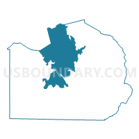
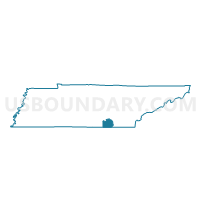
Foster Falls Voting District, Marion County, Tennessee
About
Outline

Summary
| Unique Area Identifier | 669206 |
| Name | Foster Falls Voting District |
| County | Marion County |
| State | Tennessee |
| Area (square miles) | 75.09 |
| Land Area (square miles) | 75.08 |
| Water Area (square miles) | 0.01 |
| % of Land Area | 99.98 |
| % of Water Area | 0.02 |
| Latitude of the Internal Point | 35.20261620 |
| Longtitude of the Internal Point | -85.64101630 |
Maps

Graphs
Select a template below for downloading or customizing gragh for Foster Falls Voting District, Marion County, Tennessee


Neighbors
Neighoring Voting District (by Name) Neighboring Voting District on the Map
- Battle Creek Voting District, Marion County, TN
- Coalmont Voting District, Grundy County, TN
- Gruetli Voting District, Grundy County, TN
- Jasper Voting District, Marion County, TN
- Sequatchie Voting District, Marion County, TN
- Tracy Voting District, Grundy County, TN
- Whitwell Mtn. FD Voting District, Marion County, TN
Top 10 Neighboring County Subdivision (by Population) Neighboring County Subdivision on the Map
- District 4, Marion County, TN (6,178)
- District 3, Marion County, TN (5,550)
- District 2, Marion County, TN (5,317)
- District 3, Grundy County, TN (4,613)
- District 2, Grundy County, TN (4,517)
Top 10 Neighboring Place (by Population) Neighboring Place on the Map
Top 10 Neighboring Unified School District (by Population) Neighboring Unified School District on the Map
Top 10 Neighboring State Legislative District Lower Chamber (by Population) Neighboring State Legislative District Lower Chamber on the Map
Top 10 Neighboring State Legislative District Upper Chamber (by Population) Neighboring State Legislative District Upper Chamber on the Map
Top 10 Neighboring 111th Congressional District (by Population) Neighboring 111th Congressional District on the Map
Top 10 Neighboring Census Tract (by Population) Neighboring Census Tract on the Map
- Census Tract 501.02, Marion County, TN (6,069)
- Census Tract 502.02, Marion County, TN (5,459)
- Census Tract 9553, Grundy County, TN (5,291)
- Census Tract 9552, Grundy County, TN (4,075)
- Census Tract 503.02, Marion County, TN (2,787)
Top 10 Neighboring 5-Digit ZIP Code Tabulation Area (by Population) Neighboring 5-Digit ZIP Code Tabulation Area on the Map
- 37397, TN (10,127)
- 37347, TN (7,559)
- 37380, TN (6,289)
- 37387, TN (3,323)
- 37374, TN (2,047)
- 37339, TN (2,018)