


02-2 Tennessee City C.C. Voting District, Dickson County, Tennessee
About
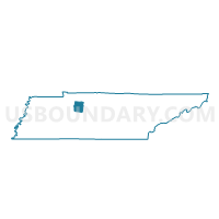
Outline

Summary
| Unique Area Identifier | 668440 |
| Name | 02-2 Tennessee City C.C. Voting District |
| County | Dickson County |
| State | Tennessee |
| Area (square miles) | 38.63 |
| Land Area (square miles) | 38.59 |
| Water Area (square miles) | 0.03 |
| % of Land Area | 99.91 |
| % of Water Area | 0.09 |
| Latitude of the Internal Point | 36.10594560 |
| Longtitude of the Internal Point | -87.51245350 |
Maps


Graphs
Select a template below for downloading or customizing gragh for 02-2 Tennessee City C.C. Voting District, Dickson County, Tennessee


Neighbors
Neighoring Voting District (by Name) Neighboring Voting District on the Map
- 01-2 Sylvia Baptist Church Voting District, Dickson County, TN
- 02-1 Eno Methodist Voting District, Dickson County, TN
- 03-2 Vanleer Townhall Voting District, Dickson County, TN
- 09-1 Superintendent's Office Voting District, Dickson County, TN
- 6-8 South McEwen Voting District, Humphreys County, TN
- 7-9 North McEwen Voting District, Humphreys County, TN
- Erin Elementary School Voting District, Houston County, TN
Top 10 Neighboring County Subdivision (by Population) Neighboring County Subdivision on the Map
- District 1, Dickson County, TN (3,986)
- District 9, Dickson County, TN (3,956)
- District 3, Dickson County, TN (3,865)
- District 2, Dickson County, TN (3,677)
- District 7, Humphreys County, TN (2,806)
- District 6, Humphreys County, TN (2,798)
- District 5, Houston County, TN (1,496)
Top 10 Neighboring Unified School District (by Population) Neighboring Unified School District on the Map
- Dickson County School District, TN (49,666)
- Humphreys County School District, TN (18,538)
- Houston County School District, TN (8,426)
Top 10 Neighboring State Legislative District Lower Chamber (by Population) Neighboring State Legislative District Lower Chamber on the Map
Top 10 Neighboring State Legislative District Upper Chamber (by Population) Neighboring State Legislative District Upper Chamber on the Map
Top 10 Neighboring 111th Congressional District (by Population) Neighboring 111th Congressional District on the Map
Top 10 Neighboring Census Tract (by Population) Neighboring Census Tract on the Map
- Census Tract 1301, Humphreys County, TN (5,399)
- Census Tract 607, Dickson County, TN (4,388)
- Census Tract 601, Dickson County, TN (4,210)
- Census Tract 606.01, Dickson County, TN (3,647)
- Census Tract 1201, Houston County, TN (3,228)
- Census Tract 1304, Humphreys County, TN (2,582)