


3 Middle School Voting District, DeKalb County, Tennessee
About
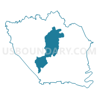
Outline

Summary
| Unique Area Identifier | 668409 |
| Name | 3 Middle School Voting District |
| County | DeKalb County |
| State | Tennessee |
| Area (square miles) | 34.73 |
| Land Area (square miles) | 31.31 |
| Water Area (square miles) | 3.42 |
| % of Land Area | 90.17 |
| % of Water Area | 9.83 |
| Latitude of the Internal Point | 35.99428610 |
| Longtitude of the Internal Point | -85.83733670 |
Maps


Graphs
Select a template below for downloading or customizing gragh for 3 Middle School Voting District, DeKalb County, Tennessee


Neighbors
Neighoring Voting District (by Name) Neighboring Voting District on the Map
- 1-2 Temperence Hall Voting District, DeKalb County, TN
- 1-3 Edgar Evins State Park Voting District, DeKalb County, TN
- 2-2 Dowelltown Voting District, DeKalb County, TN
- 2-3 Snows Hill Voting District, DeKalb County, TN
- 4-3 Courthouse Voting District, DeKalb County, TN
- 6-3 Blue Springs Voting District, DeKalb County, TN
- 7 Church of Christ Annex Voting District, DeKalb County, TN
Top 10 Neighboring County Subdivision (by Population) Neighboring County Subdivision on the Map
- District 3, DeKalb County, TN (2,890)
- District 7, DeKalb County, TN (2,881)
- District 6, DeKalb County, TN (2,871)
- District 1, DeKalb County, TN (2,517)
- District 4, DeKalb County, TN (2,482)
- District 2, DeKalb County, TN (2,428)
Top 10 Neighboring Place (by Population) Neighboring Place on the Map
Top 10 Neighboring Unified School District (by Population) Neighboring Unified School District on the Map
Top 10 Neighboring State Legislative District Lower Chamber (by Population) Neighboring State Legislative District Lower Chamber on the Map
Top 10 Neighboring State Legislative District Upper Chamber (by Population) Neighboring State Legislative District Upper Chamber on the Map
Top 10 Neighboring 111th Congressional District (by Population) Neighboring 111th Congressional District on the Map
Top 10 Neighboring Census Tract (by Population) Neighboring Census Tract on the Map
- Census Tract 9202, DeKalb County, TN (6,763)
- Census Tract 9203, DeKalb County, TN (5,447)
- Census Tract 9201.02, DeKalb County, TN (4,378)
- Census Tract 9201.01, DeKalb County, TN (2,135)