


VTD-precinct 4, Walworth County, South Dakota
About
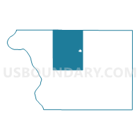
Outline

Summary
| Unique Area Identifier | 667852 |
| Name | VTD-precinct 4 |
| County | Walworth County |
| State | South Dakota |
| Area (square miles) | 106.61 |
| Land Area (square miles) | 105.87 |
| Water Area (square miles) | 0.73 |
| % of Land Area | 99.31 |
| % of Water Area | 0.69 |
| Latitude of the Internal Point | 45.50583100 |
| Longtitude of the Internal Point | -100.10900010 |
Maps


Graphs
Select a template below for downloading or customizing gragh for VTD-precinct 4, Walworth County, South Dakota


Neighbors
Neighoring Voting District (by Name) Neighboring Voting District on the Map
- VTD-precinct 10 Mobridge, Walworth County, SD
- VTD-precinct 11, Walworth County, SD
- VTD-precinct 12 Selby, Walworth County, SD
- VTD-precinct 13 Selby, Walworth County, SD
- VTD-precinct 3, Walworth County, SD
- VTD-precinct 4, Campbell County, SD
- VTD-precinct 5, Campbell County, SD
- VTD-precinct 5, Walworth County, SD
- VTD-precinct 9, Walworth County, SD
Top 10 Neighboring County Subdivision (by Population) Neighboring County Subdivision on the Map
- West Walworth UT, Walworth County, SD (674)
- Selby city, Walworth County, SD (642)
- East Walworth UT, Walworth County, SD (375)
- South Campbell UT, Campbell County, SD (364)