


VTD-precinct 1, Union County, South Dakota
About
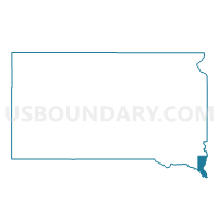
Outline

Summary
| Unique Area Identifier | 667830 |
| Name | VTD-precinct 1 |
| County | Union County |
| State | South Dakota |
| Area (square miles) | 74.69 |
| Land Area (square miles) | 74.61 |
| Water Area (square miles) | 0.08 |
| % of Land Area | 99.90 |
| % of Water Area | 0.10 |
| Latitude of the Internal Point | 43.01842670 |
| Longtitude of the Internal Point | -96.57872140 |
Maps


Graphs
Select a template below for downloading or customizing gragh for VTD-precinct 1, Union County, South Dakota


Neighbors
Neighoring Voting District (by Name) Neighboring Voting District on the Map
- BUNCOMBE TWP W/O HAWARDEN Voting District, Sioux County, IA
- HAWARDEN Voting District, Sioux County, IA
- LOGAN TWP W/O CHATSWORTH & HAWARDEN Voting District, Sioux County, IA
- PORTLAND TWP Voting District, Plymouth County, IA
- VTD - Alcester ward 2 (part of precinct 2), Union County, SD
- VTD - Alcester ward 3 (part of precinct 2), Union County, SD
- VTD precinct 5, Union County, SD
- VTD-Alcester ward 1 (part of precinct 2), Union County, SD
- VTD-Hudson/Eden, Lincoln County, SD
- VTD-Norway township, Lincoln County, SD
- VTD-precinct 26 Brooklyn, Pleasant twps, Beresford town, Lincoln County, SD
- VTD-precinct 3, Union County, SD
Top 10 Neighboring County Subdivision (by Population) Neighboring County Subdivision on the Map
- Buncombe township, Sioux County, IA (2,032)
- Portland township, Plymouth County, IA (1,755)
- Alcester city, Union County, SD (807)
- Logan township, Sioux County, IA (784)
- Pleasant township, Lincoln County, SD (323)
- Big Springs township, Union County, SD (275)
- Alcester township, Union County, SD (274)
- Sioux Valley township, Union County, SD (243)
- Norway township, Lincoln County, SD (242)
- Virginia township, Union County, SD (240)
Top 10 Neighboring Place (by Population) Neighboring Place on the Map
Top 10 Neighboring Unified School District (by Population) Neighboring Unified School District on the Map
- West Sioux Community School District, IA (4,206)
- Beresford School District 61-2, SD (3,381)
- Alcester-Hudson School District 61-1, SD (2,273)
- Greater Hoyt School District 61-4, SD (305)
- Greater Scott School District 61-5, SD (112)
Top 10 Neighboring State Legislative District Lower Chamber (by Population) Neighboring State Legislative District Lower Chamber on the Map
Top 10 Neighboring State Legislative District Upper Chamber (by Population) Neighboring State Legislative District Upper Chamber on the Map
Top 10 Neighboring 111th Congressional District (by Population) Neighboring 111th Congressional District on the Map
Top 10 Neighboring Census Tract (by Population) Neighboring Census Tract on the Map
- Census Tract 201, Union County, SD (4,157)
- Census Tract 704, Sioux County, IA (4,114)
- Census Tract 9703, Plymouth County, IA (3,326)
- Census Tract 104, Lincoln County, SD (2,592)