


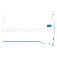
VTD-Hazel precinct, Hamlin County, South Dakota
About
Outline

Summary
| Unique Area Identifier | 667340 |
| Name | VTD-Hazel precinct |
| County | Hamlin County |
| State | South Dakota |
| Area (square miles) | 53.72 |
| Land Area (square miles) | 53.61 |
| Water Area (square miles) | 0.11 |
| % of Land Area | 99.80 |
| % of Water Area | 0.20 |
| Latitude of the Internal Point | 44.76783940 |
| Longtitude of the Internal Point | -97.40019270 |
Maps

Graphs
Select a template below for downloading or customizing gragh for VTD-Hazel precinct, Hamlin County, South Dakota


Neighbors
Neighoring Voting District (by Name) Neighboring Voting District on the Map
- VTD Bryant precinct, Hamlin County, SD
- VTD Hayti precinct, Hamlin County, SD
- VTD precinct Graceland and Henry, Codington County, SD
- VTD precinct Kampeska, Codington County, SD
- VTD-Oxford precinct, Hamlin County, SD
- VTD-precinct 6, Clark County, SD
- VTD-precinct 9, Clark County, SD
Top 10 Neighboring County Subdivision (by Population) Neighboring County Subdivision on the Map
- Oxford township, Hamlin County, SD (332)
- Kampeska township, Codington County, SD (321)
- Opdahl township, Hamlin County, SD (197)
- Pleasant township, Clark County, SD (166)
- Brantford township, Hamlin County, SD (123)
- Dixon township, Hamlin County, SD (116)
- Henry township, Codington County, SD (94)
- Hazel town, Hamlin County, SD (91)
- Elrod township, Clark County, SD (90)
- Foxton township, Clark County, SD (51)
Top 10 Neighboring Place (by Population) Neighboring Place on the Map
Top 10 Neighboring Unified School District (by Population) Neighboring Unified School District on the Map
- Watertown School District 14-4, SD (25,013)
- Hamlin School District 28-3, SD (3,314)
- Willow Lake School District 12-3, SD (1,060)
- Henry School District 14-2, SD (534)
Top 10 Neighboring State Legislative District Lower Chamber (by Population) Neighboring State Legislative District Lower Chamber on the Map
Top 10 Neighboring State Legislative District Upper Chamber (by Population) Neighboring State Legislative District Upper Chamber on the Map
Top 10 Neighboring 111th Congressional District (by Population) Neighboring 111th Congressional District on the Map
Top 10 Neighboring Census Tract (by Population) Neighboring Census Tract on the Map
- Census Tract 9558, Clark County, SD (3,691)
- Census Tract 9552, Hamlin County, SD (3,151)
- Census Tract 9546, Codington County, SD (2,436)