


VTD-precinct 3, Aurora County, South Dakota
About
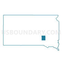
Outline

Summary
| Unique Area Identifier | 666992 |
| Name | VTD-precinct 3 |
| County | Aurora County |
| State | South Dakota |
| Area (square miles) | 181.72 |
| Land Area (square miles) | 178.24 |
| Water Area (square miles) | 3.48 |
| % of Land Area | 98.08 |
| % of Water Area | 1.92 |
| Latitude of the Internal Point | 43.66505860 |
| Longtitude of the Internal Point | -98.70391870 |
Maps


Graphs
Select a template below for downloading or customizing gragh for VTD-precinct 3, Aurora County, South Dakota


Neighbors
Neighoring Voting District (by Name) Neighboring Voting District on the Map
- VTD precinct 2, Brule County, SD
- VTD precinct 4, Brule County, SD
- VTD precinct 9, Charles Mix County, SD
- VTD-precinct 1, Douglas County, SD
- VTD-precinct 2, Aurora County, SD
- VTD-precinct 4, Aurora County, SD
- VTD-precinct 5, Aurora County, SD
Top 10 Neighboring County Subdivision (by Population) Neighboring County Subdivision on the Map
- White Lake city, Aurora County, SD (372)
- Plankinton township, Aurora County, SD (211)
- Torrey Lake township, Brule County, SD (180)
- Joubert township, Douglas County, SD (127)
- White Lake township, Aurora County, SD (87)
- Center township, Aurora County, SD (85)
- Truro township, Aurora County, SD (79)
- Pleasant Lake township, Aurora County, SD (74)
- Gales township, Aurora County, SD (54)
- Carroll township, Charles Mix County, SD (53)
Top 10 Neighboring Place (by Population) Neighboring Place on the Map
Top 10 Neighboring Unified School District (by Population) Neighboring Unified School District on the Map
- Platte-Geddes School District 11-5, SD (3,157)
- Kimball School District 07-2, SD (1,461)
- Plankinton School District 01-1, SD (1,281)
- Stickney School District 01-2, SD (729)
- White Lake School District 01-3, SD (723)
Top 10 Neighboring State Legislative District Lower Chamber (by Population) Neighboring State Legislative District Lower Chamber on the Map
- State House District 20, SD (22,214)
- State House District 21, SD (21,057)
- State House District 19, SD (19,075)
Top 10 Neighboring State Legislative District Upper Chamber (by Population) Neighboring State Legislative District Upper Chamber on the Map
- State Senate District 20, SD (22,214)
- State Senate District 21, SD (21,057)
- State Senate District 19, SD (19,075)
Top 10 Neighboring 111th Congressional District (by Population) Neighboring 111th Congressional District on the Map
Top 10 Neighboring Census Tract (by Population) Neighboring Census Tract on the Map
- Census Tract 9696, Douglas County, SD (3,002)
- Census Tract 9736, Aurora County, SD (2,710)
- Census Tract 9701, Charles Mix County, SD (2,664)
- Census Tract 9731, Brule County, SD (2,657)
Top 10 Neighboring 5-Digit ZIP Code Tabulation Area (by Population) Neighboring 5-Digit ZIP Code Tabulation Area on the Map
- 57369, SD (2,495)
- 57355, SD (1,352)
- 57368, SD (1,226)
- 57383, SD (732)
- 57375, SD (647)
- 57344, SD (155)