


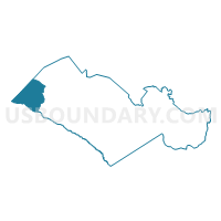
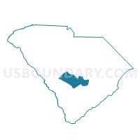
Springfield Voting District, Orangeburg County, South Carolina
About
Outline

Summary
| Unique Area Identifier | 666481 |
| Name | Springfield Voting District |
| County | Orangeburg County |
| State | South Carolina |
| Area (square miles) | 64.78 |
| Land Area (square miles) | 64.58 |
| Water Area (square miles) | 0.20 |
| % of Land Area | 99.69 |
| % of Water Area | 0.31 |
| Latitude of the Internal Point | 33.51461170 |
| Longtitude of the Internal Point | -81.26111530 |
Maps

Graphs
Select a template below for downloading or customizing gragh for Springfield Voting District, Orangeburg County, South Carolina


Neighbors
Neighoring Voting District (by Name) Neighboring Voting District on the Map
- Healing Springs Voting District, Barnwell County, SC
- Neeses-Livingston Voting District, Orangeburg County, SC
- North 1 Voting District, Orangeburg County, SC
- Norway Voting District, Orangeburg County, SC
- Perry Voting District, Aiken County, SC
- Salley Voting District, Aiken County, SC
- West Denmark Voting District, Bamberg County, SC
- White Pond Voting District, Aiken County, SC
- Williston No. 1 Voting District, Barnwell County, SC
Top 10 Neighboring County Subdivision (by Population) Neighboring County Subdivision on the Map
- Windsor CCD, Aiken County, SC (6,149)
- Denmark CCD, Bamberg County, SC (6,016)
- Williston CCD, Barnwell County, SC (5,701)
- Neeses CCD, Orangeburg County, SC (4,352)
- Blackville CCD, Barnwell County, SC (3,873)
- Salley CCD, Aiken County, SC (2,589)
- Norway CCD, Orangeburg County, SC (2,468)
- Springfield CCD, Orangeburg County, SC (2,139)
Top 10 Neighboring Place (by Population) Neighboring Place on the Map
Top 10 Neighboring Unified School District (by Population) Neighboring Unified School District on the Map
- Aiken County School District, SC (162,758)
- Orangeburg School District 5, SC (51,950)
- Orangeburg School District 4, SC (20,430)
- Bamberg School District 2, SC (7,177)
- Barnwell School District 29, SC (5,135)
- Barnwell School District 19, SC (5,096)
Top 10 Neighboring State Legislative District Lower Chamber (by Population) Neighboring State Legislative District Lower Chamber on the Map
- State House District 96, SC (41,272)
- State House District 86, SC (39,715)
- State House District 90, SC (32,339)
- State House District 91, SC (30,470)
Top 10 Neighboring State Legislative District Upper Chamber (by Population) Neighboring State Legislative District Upper Chamber on the Map
Top 10 Neighboring 111th Congressional District (by Population) Neighboring 111th Congressional District on the Map
Top 10 Neighboring Census Tract (by Population) Neighboring Census Tract on the Map
- Census Tract 219, Aiken County, SC (6,149)
- Census Tract 9601, Bamberg County, SC (6,016)
- Census Tract 9701, Barnwell County, SC (5,701)
- Census Tract 118, Orangeburg County, SC (4,607)
- Census Tract 119, Orangeburg County, SC (4,352)
- Census Tract 9702, Barnwell County, SC (3,873)
- Census Tract 218, Aiken County, SC (2,589)
Top 10 Neighboring 5-Digit ZIP Code Tabulation Area (by Population) Neighboring 5-Digit ZIP Code Tabulation Area on the Map
- 29853, SC (6,580)
- 29817, SC (4,913)
- 29112, SC (4,712)
- 29107, SC (3,166)
- 29137, SC (2,539)
- 29146, SC (1,767)
- 29113, SC (1,618)