


Santee Voting District, Georgetown County, South Carolina
About
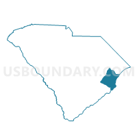
Outline

Summary
| Unique Area Identifier | 665777 |
| Name | Santee Voting District |
| County | Georgetown County |
| State | South Carolina |
| Area (square miles) | 193.44 |
| Land Area (square miles) | 126.79 |
| Water Area (square miles) | 66.66 |
| % of Land Area | 65.54 |
| % of Water Area | 34.46 |
| Latitude of the Internal Point | 33.20122120 |
| Longtitude of the Internal Point | -79.28613390 |
Maps


Graphs
Select a template below for downloading or customizing gragh for Santee Voting District, Georgetown County, South Carolina


Neighbors
Neighoring Voting District (by Name) Neighboring Voting District on the Map
- Cedar Creek Voting District, Georgetown County, SC
- McClellanville Voting District, Charleston County, SC
- Pawley's Island No. 4 Voting District, Georgetown County, SC
- Penny Royal Voting District, Georgetown County, SC
- Sampit Voting District, Georgetown County, SC
- Shulerville Voting District, Berkeley County, SC
- Winyah Bay Voting District, Georgetown County, SC
Top 10 Neighboring County Subdivision (by Population) Neighboring County Subdivision on the Map
- Waccamaw Neck CCD, Georgetown County, SC (22,223)
- Georgetown CCD, Georgetown County, SC (19,865)
- McClellanville CCD, Charleston County, SC (4,913)
- Cordesville CCD, Berkeley County, SC (4,016)
- Sampit-North Santee CCD, Georgetown County, SC (3,913)
Top 10 Neighboring Unified School District (by Population) Neighboring Unified School District on the Map
- Charleston County School District, SC (350,209)
- Berkeley County School District, SC (177,843)
- Georgetown County School District, SC (60,158)
Top 10 Neighboring State Legislative District Lower Chamber (by Population) Neighboring State Legislative District Lower Chamber on the Map
- State House District 108, SC (38,039)
- State House District 102, SC (37,248)
- State House District 103, SC (30,594)
Top 10 Neighboring State Legislative District Upper Chamber (by Population) Neighboring State Legislative District Upper Chamber on the Map
- State Senate District 37, SC (116,420)
- State Senate District 34, SC (116,206)
- State Senate District 32, SC (81,778)
Top 10 Neighboring 111th Congressional District (by Population) Neighboring 111th Congressional District on the Map
Top 10 Neighboring Census Tract (by Population) Neighboring Census Tract on the Map
- Census Tract 9207, Georgetown County, SC (5,433)
- Census Tract 50, Charleston County, SC (4,913)
- Census Tract 204.01, Berkeley County, SC (4,016)
- Census Tract 9208, Georgetown County, SC (3,913)
- Census Tract 9205.05, Georgetown County, SC (3,687)
- Census Tract 9901, Georgetown County, SC (0)
- Census Tract 9901, Charleston County, SC (0)