


Ladson Voting District, Charleston County, South Carolina
About
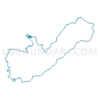
Outline

Summary
| Unique Area Identifier | 665340 |
| Name | Ladson Voting District |
| County | Charleston County |
| State | South Carolina |
| Area (square miles) | 2.60 |
| Land Area (square miles) | 2.60 |
| Water Area (square miles) | 0.00 |
| % of Land Area | 100.00 |
| % of Water Area | 0.00 |
| Latitude of the Internal Point | 32.99650920 |
| Longtitude of the Internal Point | -80.12742880 |
Maps


Graphs
Select a template below for downloading or customizing gragh for Ladson Voting District, Charleston County, South Carolina


Neighbors
Neighoring Voting District (by Name) Neighboring Voting District on the Map
- Coastal Center Voting District, Dorchester County, SC
- Deer Park 1B Voting District, Charleston County, SC
- Greenhurst Voting District, Dorchester County, SC
- Licolnville Voting District, Charleston County, SC
- Miles/Jamison Voting District, Dorchester County, SC
- Sangree No. 1 Voting District, Berkeley County, SC
- Stratford No. 3 Voting District, Berkeley County, SC
Top 10 Neighboring County Subdivision (by Population) Neighboring County Subdivision on the Map
- Summerville CCD, Dorchester County, SC (117,093)
- Goose Creek-Hanahan CCD, Berkeley County, SC (114,128)
- North Charleston CCD, Charleston County, SC (88,544)
Top 10 Neighboring Place (by Population) Neighboring Place on the Map
- North Charleston city, SC (97,471)
- Summerville town, SC (43,392)
- Ladson CDP, SC (13,790)
- Lincolnville town, SC (1,139)
Top 10 Neighboring Unified School District (by Population) Neighboring Unified School District on the Map
- Charleston County School District, SC (350,209)
- Berkeley County School District, SC (177,843)
- Dorchester School District 2, SC (119,266)
Top 10 Neighboring State Legislative District Lower Chamber (by Population) Neighboring State Legislative District Lower Chamber on the Map
- State House District 117, SC (44,750)
- State House District 92, SC (40,550)
- State House District 94, SC (39,444)
- State House District 113, SC (29,036)
Top 10 Neighboring State Legislative District Upper Chamber (by Population) Neighboring State Legislative District Upper Chamber on the Map
- State Senate District 38, SC (132,422)
- State Senate District 44, SC (110,046)
- State Senate District 43, SC (96,781)
Top 10 Neighboring 111th Congressional District (by Population) Neighboring 111th Congressional District on the Map
Top 10 Neighboring Census Tract (by Population) Neighboring Census Tract on the Map
- Census Tract 108.13, Dorchester County, SC (8,688)
- Census Tract 207.16, Berkeley County, SC (7,320)
- Census Tract 108.14, Dorchester County, SC (6,212)
- Census Tract 31.06, Charleston County, SC (5,955)
- Census Tract 207.14, Berkeley County, SC (5,315)
- Census Tract 31.07, Charleston County, SC (4,397)
- Census Tract 108.09, Dorchester County, SC (3,386)
- Census Tract 207.21, Berkeley County, SC (3,324)