


ASTON TWP WD 07, Delaware County, Pennsylvania
About
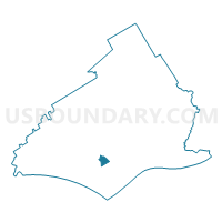
Outline

Summary
| Unique Area Identifier | 659092 |
| Name | ASTON TWP WD 07 |
| County | Delaware County |
| State | Pennsylvania |
| Area (square miles) | 0.60 |
| Land Area (square miles) | 0.60 |
| Water Area (square miles) | 0.00 |
| % of Land Area | 100.00 |
| % of Water Area | 0.00 |
| Latitude of the Internal Point | 39.86090040 |
| Longtitude of the Internal Point | -75.42214600 |
Maps


Graphs
Select a template below for downloading or customizing gragh for ASTON TWP WD 07, Delaware County, Pennsylvania


Neighbors
Neighoring Voting District (by Name) Neighboring Voting District on the Map
- ASTON TWP WD 01, Delaware County, PA
- ASTON TWP WD 04, Delaware County, PA
- ASTON TWP WD 05, Delaware County, PA
- ASTON TWP WD 06, Delaware County, PA
- CHESTER TWP PCT 02, Delaware County, PA
- UPPER CHICHESTER TWP WD 02 DIST 02, Delaware County, PA
- UPPER CHICHESTER TWP WD 03 DIST 02, Delaware County, PA
Top 10 Neighboring County Subdivision (by Population) Neighboring County Subdivision on the Map
- Upper Chichester township, Delaware County, PA (16,738)
- Aston township, Delaware County, PA (16,592)
- Chester township, Delaware County, PA (3,940)
Top 10 Neighboring Place (by Population) Neighboring Place on the Map
Top 10 Neighboring Unified School District (by Population) Neighboring Unified School District on the Map
- Chester-Upland School District, PA (41,151)
- Penn-Delco School District, PA (26,926)
- Chichester School District, PA (24,432)
Top 10 Neighboring State Legislative District Lower Chamber (by Population) Neighboring State Legislative District Lower Chamber on the Map
- State House District 160, PA (73,500)
- State House District 161, PA (62,028)
- State House District 159, PA (55,766)
Top 10 Neighboring State Legislative District Upper Chamber (by Population) Neighboring State Legislative District Upper Chamber on the Map
Top 10 Neighboring 111th Congressional District (by Population) Neighboring 111th Congressional District on the Map
Top 10 Neighboring Census Tract (by Population) Neighboring Census Tract on the Map
- Census Tract 4069.02, Delaware County, PA (5,866)
- Census Tract 4069.04, Delaware County, PA (5,696)
- Census Tract 4069.03, Delaware County, PA (5,030)
- Census Tract 4068.01, Delaware County, PA (4,295)
- Census Tract 4064.02, Delaware County, PA (1,085)