


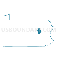
BERWICK 1ST WARD, Columbia County, Pennsylvania
About
Outline

Summary
| Unique Area Identifier | 658671 |
| Name | BERWICK 1ST WARD |
| County | Columbia County |
| State | Pennsylvania |
| Area (square miles) | 0.81 |
| Land Area (square miles) | 0.79 |
| Water Area (square miles) | 0.02 |
| % of Land Area | 97.56 |
| % of Water Area | 2.44 |
| Latitude of the Internal Point | 41.06428700 |
| Longtitude of the Internal Point | -76.23558630 |
Maps


Graphs
Select a template below for downloading or customizing gragh for BERWICK 1ST WARD, Columbia County, Pennsylvania


Neighbors
Neighoring Voting District (by Name) Neighboring Voting District on the Map
- BERWICK WD 02, Columbia County, PA
- BRIAR CREEK TWP VTD NORTHEAST, Columbia County, PA
- MIFFLIN TWP Voting District, Columbia County, PA
- NESCOPECK TWP Voting District, Luzerne County, PA
- SALEM TWP 02 Voting District, Luzerne County, PA
Top 10 Neighboring County Subdivision (by Population) Neighboring County Subdivision on the Map
- Berwick borough, Columbia County, PA (10,477)
- Salem township, Luzerne County, PA (4,254)
- Briar Creek township, Columbia County, PA (3,016)
- Mifflin township, Columbia County, PA (2,322)
- Nescopeck township, Luzerne County, PA (1,155)
Top 10 Neighboring Place (by Population) Neighboring Place on the Map
Top 10 Neighboring Unified School District (by Population) Neighboring Unified School District on the Map
Top 10 Neighboring State Legislative District Lower Chamber (by Population) Neighboring State Legislative District Lower Chamber on the Map
Top 10 Neighboring State Legislative District Upper Chamber (by Population) Neighboring State Legislative District Upper Chamber on the Map
Top 10 Neighboring 111th Congressional District (by Population) Neighboring 111th Congressional District on the Map
Top 10 Neighboring Census Tract (by Population) Neighboring Census Tract on the Map
- Census Tract 2162, Luzerne County, PA (5,387)
- Census Tract 506, Columbia County, PA (5,331)
- Census Tract 2161, Luzerne County, PA (4,254)
- Census Tract 505, Columbia County, PA (3,760)
- Census Tract 514, Columbia County, PA (2,583)