


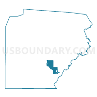
WOODWARD TWP PCT 02, Clearfield County, Pennsylvania
About
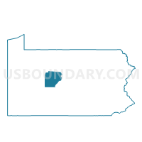
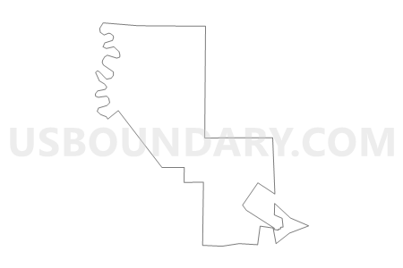
Outline

Summary
| Unique Area Identifier | 658632 |
| Name | WOODWARD TWP PCT 02 |
| County | Clearfield County |
| State | Pennsylvania |
| Area (square miles) | 14.74 |
| Land Area (square miles) | 14.65 |
| Water Area (square miles) | 0.09 |
| % of Land Area | 99.39 |
| % of Water Area | 0.61 |
| Latitude of the Internal Point | 40.86815130 |
| Longtitude of the Internal Point | -78.39020770 |
Maps

Graphs
Select a template below for downloading or customizing gragh for WOODWARD TWP PCT 02, Clearfield County, Pennsylvania


Neighbors
Neighoring Voting District (by Name) Neighboring Voting District on the Map
- BIGLER TWP Voting District, Clearfield County, PA
- BOGGS TWP Voting District, Clearfield County, PA
- BRISBIN Voting District, Clearfield County, PA
- DECATUR TWP PCT 01, Clearfield County, PA
- HOUTZDALE Voting District, Clearfield County, PA
- KNOX TWP Voting District, Clearfield County, PA
- WOODWARD TWP PCT 01, Clearfield County, PA
Top 10 Neighboring County Subdivision (by Population) Neighboring County Subdivision on the Map
- Decatur township, Clearfield County, PA (4,548)
- Woodward township, Clearfield County, PA (3,992)
- Boggs township, Clearfield County, PA (1,751)
- Bigler township, Clearfield County, PA (1,289)
- Houtzdale borough, Clearfield County, PA (797)
- Knox township, Clearfield County, PA (647)
- Brisbin borough, Clearfield County, PA (411)
Top 10 Neighboring Place (by Population) Neighboring Place on the Map
Top 10 Neighboring Unified School District (by Population) Neighboring Unified School District on the Map
- Clearfield Area School District, PA (19,134)
- Philipsburg-Osceola Area School District, PA (15,412)
- Moshannon Valley School District, PA (8,778)
Top 10 Neighboring State Legislative District Lower Chamber (by Population) Neighboring State Legislative District Lower Chamber on the Map
Top 10 Neighboring State Legislative District Upper Chamber (by Population) Neighboring State Legislative District Upper Chamber on the Map
Top 10 Neighboring 111th Congressional District (by Population) Neighboring 111th Congressional District on the Map
Top 10 Neighboring Census Tract (by Population) Neighboring Census Tract on the Map
- Census Tract 3317, Clearfield County, PA (6,886)
- Census Tract 3309, Clearfield County, PA (6,572)
- Census Tract 3310, Clearfield County, PA (5,098)
- Census Tract 3316, Clearfield County, PA (2,539)