


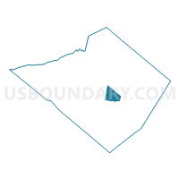
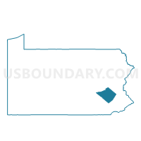
ALSACE TWP DIST 01, Berks County, Pennsylvania
About
Outline

Summary
| Unique Area Identifier | 657240 |
| Name | ALSACE TWP DIST 01 |
| County | Berks County |
| State | Pennsylvania |
| Area (square miles) | 12.18 |
| Land Area (square miles) | 12.16 |
| Water Area (square miles) | 0.02 |
| % of Land Area | 99.81 |
| % of Water Area | 0.19 |
| Latitude of the Internal Point | 40.38586010 |
| Longtitude of the Internal Point | -75.85786220 |
Maps

Graphs
Select a template below for downloading or customizing gragh for ALSACE TWP DIST 01, Berks County, Pennsylvania


Neighbors
Neighoring Voting District (by Name) Neighboring Voting District on the Map
- EXETER TWP DIST 10, Berks County, PA
- LOWER ALSACE TWP DIST 02, Berks County, PA
- MUHLENBERG TWP DIST 02, Berks County, PA
- MUHLENBERG TWP DIST 04, Berks County, PA
- OLEY TWP DIST 01, Berks County, PA
- READING WD 17 PCT 08, Berks County, PA
- RUSCOMBMANOR TWP DIST 02, Berks County, PA
Top 10 Neighboring County Subdivision (by Population) Neighboring County Subdivision on the Map
- Reading city, Berks County, PA (88,082)
- Exeter township, Berks County, PA (25,550)
- Muhlenberg township, Berks County, PA (19,628)
- Lower Alsace township, Berks County, PA (4,475)
- Ruscombmanor township, Berks County, PA (4,112)
- Alsace township, Berks County, PA (3,751)
- Oley township, Berks County, PA (3,620)
Top 10 Neighboring Place (by Population) Neighboring Place on the Map
Top 10 Neighboring Unified School District (by Population) Neighboring Unified School District on the Map
- Reading School District, PA (88,082)
- Exeter Township School District, PA (27,359)
- Muhlenberg School District, PA (23,539)
- Oley Valley School District, PA (13,206)
- Antietam School District, PA (7,581)
Top 10 Neighboring State Legislative District Lower Chamber (by Population) Neighboring State Legislative District Lower Chamber on the Map
Top 10 Neighboring State Legislative District Upper Chamber (by Population) Neighboring State Legislative District Upper Chamber on the Map
Top 10 Neighboring 111th Congressional District (by Population) Neighboring 111th Congressional District on the Map
Top 10 Neighboring Census Tract (by Population) Neighboring Census Tract on the Map
- Census Tract 134.01, Berks County, PA (7,890)
- Census Tract 129, Berks County, PA (7,371)
- Census Tract 124, Berks County, PA (6,370)
- Census Tract 123, Berks County, PA (4,443)
- Census Tract 6, Berks County, PA (3,261)
- Census Tract 121.04, Berks County, PA (3,160)
- Census Tract 121.03, Berks County, PA (2,322)
Top 10 Neighboring 5-Digit ZIP Code Tabulation Area (by Population) Neighboring 5-Digit ZIP Code Tabulation Area on the Map
- 19606, PA (34,416)
- 19604, PA (27,658)
- 19605, PA (18,985)
- 19522, PA (14,229)
- 19560, PA (7,805)
- 19547, PA (4,222)