


AMBRIDGE BORO 02 PCT 01, Beaver County, Pennsylvania
About
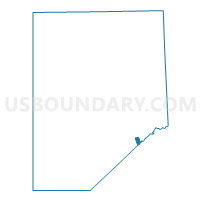
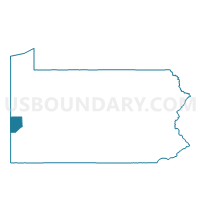
Outline

Summary
| Unique Area Identifier | 657073 |
| Name | AMBRIDGE BORO 02 PCT 01 |
| County | Beaver County |
| State | Pennsylvania |
| Area (square miles) | 0.49 |
| Land Area (square miles) | 0.39 |
| Water Area (square miles) | 0.11 |
| % of Land Area | 78.51 |
| % of Water Area | 21.49 |
| Latitude of the Internal Point | 40.58048290 |
| Longtitude of the Internal Point | -80.22884790 |
Maps

Graphs
Select a template below for downloading or customizing gragh for AMBRIDGE BORO 02 PCT 01, Beaver County, Pennsylvania


Neighbors
Neighoring Voting District (by Name) Neighboring Voting District on the Map
- ALIQUIPPA VTD 02, Beaver County, PA
- AMBRIDGE BORO 02 PCT 02, Beaver County, PA
- AMBRIDGE BORO 02 PCT 03, Beaver County, PA
- AMBRIDGE BORO 02 PCT 04, Beaver County, PA
- CRESCENT TWP WD 02, Allegheny County, PA
- HOPEWELL TWP VTD 06, Beaver County, PA
- LEETSDALE DIST 01, Allegheny County, PA
- SOUTH HEIGHTS Voting District, Beaver County, PA
Top 10 Neighboring County Subdivision (by Population) Neighboring County Subdivision on the Map
- Hopewell township, Beaver County, PA (12,593)
- Aliquippa city, Beaver County, PA (9,438)
- Ambridge borough, Beaver County, PA (7,050)
- Crescent township, Allegheny County, PA (2,640)
- Leetsdale borough, Allegheny County, PA (1,218)
- South Heights borough, Beaver County, PA (475)
Top 10 Neighboring Place (by Population) Neighboring Place on the Map
- Aliquippa city, PA (9,438)
- Ambridge borough, PA (7,050)
- Leetsdale borough, PA (1,218)
- South Heights borough, PA (475)
Top 10 Neighboring Unified School District (by Population) Neighboring Unified School District on the Map
- Moon Area School District, PA (26,825)
- Ambridge Area School District, PA (23,827)
- Hopewell Area School District, PA (18,145)
- Quaker Valley School District, PA (13,934)
- Aliquippa School District, PA (9,438)
Top 10 Neighboring State Legislative District Lower Chamber (by Population) Neighboring State Legislative District Lower Chamber on the Map
Top 10 Neighboring State Legislative District Upper Chamber (by Population) Neighboring State Legislative District Upper Chamber on the Map
Top 10 Neighboring 111th Congressional District (by Population) Neighboring 111th Congressional District on the Map
Top 10 Neighboring Census Tract (by Population) Neighboring Census Tract on the Map
- Census Tract 6048, Beaver County, PA (4,414)
- Census Tract 6041, Beaver County, PA (2,864)
- Census Tract 4490, Allegheny County, PA (2,640)
- Census Tract 6057, Beaver County, PA (2,634)
- Census Tract 6042, Beaver County, PA (1,624)
- Census Tract 4480, Allegheny County, PA (1,218)