


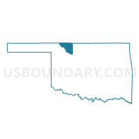
Voting District 7, Woods County, Oklahoma
About
Outline

Summary
| Unique Area Identifier | 655588 |
| Name | Voting District 7 |
| County | Woods County |
| State | Oklahoma |
| Area (square miles) | 164.90 |
| Land Area (square miles) | 164.58 |
| Water Area (square miles) | 0.32 |
| % of Land Area | 99.81 |
| % of Water Area | 0.19 |
| Latitude of the Internal Point | 36.51369400 |
| Longtitude of the Internal Point | -98.64028790 |
Maps


Graphs
Select a template below for downloading or customizing gragh for Voting District 7, Woods County, Oklahoma


Neighbors
Neighoring Voting District (by Name) Neighboring Voting District on the Map
- Voting District 2, Woods County, OK
- Voting District 220, Alfalfa County, OK
- Voting District 230, Alfalfa County, OK
- Voting District 240, Alfalfa County, OK
- Voting District 3, Woods County, OK
- Voting District 4, Woods County, OK
- Voting District 4, Major County, OK
- Voting District 7, Major County, OK
- Voting District 9, Major County, OK
Top 10 Neighboring County Subdivision (by Population) Neighboring County Subdivision on the Map
- Fairview CCD, Major County, OK (4,376)
- East Major CCD, Major County, OK (3,151)
- South Woods CCD, Woods County, OK (1,761)
- Carmen CCD, Alfalfa County, OK (760)
Top 10 Neighboring Unified School District (by Population) Neighboring Unified School District on the Map
- Alva Public Schools, OK (7,376)
- Fairview Public Schools, OK (3,694)
- Waynoka Public Schools, OK (1,461)
- Aline-Cleo Public Schools, OK (1,084)
Top 10 Neighboring State Legislative District Lower Chamber (by Population) Neighboring State Legislative District Lower Chamber on the Map
Top 10 Neighboring State Legislative District Upper Chamber (by Population) Neighboring State Legislative District Upper Chamber on the Map
Top 10 Neighboring 111th Congressional District (by Population) Neighboring 111th Congressional District on the Map
Top 10 Neighboring Census Tract (by Population) Neighboring Census Tract on the Map
- Census Tract 9551, Major County, OK (3,151)
- Census Tract 9560, Alfalfa County, OK (2,835)
- Census Tract 9544, Woods County, OK (1,761)
- Census Tract 9552, Major County, OK (1,584)
Top 10 Neighboring 5-Digit ZIP Code Tabulation Area (by Population) Neighboring 5-Digit ZIP Code Tabulation Area on the Map
- 73717, OK (6,846)
- 73737, OK (3,367)
- 73728, OK (1,861)
- 73860, OK (1,337)
- 73729, OK (578)
- 73716, OK (510)
- 73726, OK (472)
- 73731, OK (171)