


Voting District 202, Le Flore County, Oklahoma
About
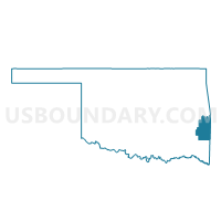
Outline

Summary
| Unique Area Identifier | 654274 |
| Name | Voting District 202 |
| County | Le Flore County |
| State | Oklahoma |
| Area (square miles) | 29.03 |
| Land Area (square miles) | 28.81 |
| Water Area (square miles) | 0.21 |
| % of Land Area | 99.26 |
| % of Water Area | 0.74 |
| Latitude of the Internal Point | 35.01884830 |
| Longtitude of the Internal Point | -94.76632810 |
Maps


Graphs
Select a template below for downloading or customizing gragh for Voting District 202, Le Flore County, Oklahoma


Neighbors
Neighoring Voting District (by Name) Neighboring Voting District on the Map
- Voting District 111, Le Flore County, OK
- Voting District 201, Le Flore County, OK
- Voting District 205, Le Flore County, OK
- Voting District 212, Le Flore County, OK
- Voting District 213, Le Flore County, OK
Top 10 Neighboring County Subdivision (by Population) Neighboring County Subdivision on the Map
Top 10 Neighboring Place (by Population) Neighboring Place on the Map
Top 10 Neighboring Elementary School District (by Population) Neighboring Elementary School District on the Map
Top 10 Neighboring Unified School District (by Population) Neighboring Unified School District on the Map
- Poteau Public Schools, OK (11,094)
- Panama Public Schools, OK (3,348)
- Wister Public Schools, OK (2,309)
Top 10 Neighboring State Legislative District Lower Chamber (by Population) Neighboring State Legislative District Lower Chamber on the Map
- State House District 17, OK (36,307)
- State House District 3, OK (35,355)
- State House District 19, OK (34,076)