


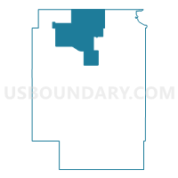
Voting District 130, Craig County, Oklahoma
About
Outline

Summary
| Unique Area Identifier | 653859 |
| Name | Voting District 130 |
| County | Craig County |
| State | Oklahoma |
| Area (square miles) | 78.00 |
| Land Area (square miles) | 77.95 |
| Water Area (square miles) | 0.06 |
| % of Land Area | 99.93 |
| % of Water Area | 0.07 |
| Latitude of the Internal Point | 36.92741060 |
| Longtitude of the Internal Point | -95.23076420 |
Maps


Graphs
Select a template below for downloading or customizing gragh for Voting District 130, Craig County, Oklahoma


Neighbors
Neighoring Voting District (by Name) Neighboring Voting District on the Map
- Voting District 101, Craig County, OK
- Voting District 140, Craig County, OK
- Voting District 320, Craig County, OK
- Voting District 410, Craig County, OK
- Elm Grove Township Voting District, Labette County, KS
- Hackberry Township Voting District, Labette County, KS
- Richland Township Voting District, Labette County, KS
Top 10 Neighboring County Subdivision (by Population) Neighboring County Subdivision on the Map
- North Craig CCD, Craig County, OK (3,061)
- Elm Grove township, Labette County, KS (823)
- Hackberry township, Labette County, KS (392)
- Richland township, Labette County, KS (287)
Top 10 Neighboring Unified School District (by Population) Neighboring Unified School District on the Map
- Labette County Unified School District 506, KS (7,770)
- Chetopa-St. Paul Unified School District 505, KS (2,652)
- Welch Public Schools, OK (1,882)
- Bluejacket Public Schools, OK (1,531)
Top 10 Neighboring State Legislative District Lower Chamber (by Population) Neighboring State Legislative District Lower Chamber on the Map
Top 10 Neighboring State Legislative District Upper Chamber (by Population) Neighboring State Legislative District Upper Chamber on the Map
- State Senate District 1, OK (75,819)
- State Senate District 29, OK (74,057)
- State Senate District 14, KS (61,993)