


PRECINCT FLORENCE, Williams County, Ohio
About
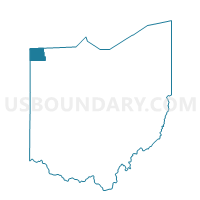
Outline

Summary
| Unique Area Identifier | 653311 |
| Name | PRECINCT FLORENCE |
| County | Williams County |
| State | Ohio |
| Area (square miles) | 41.80 |
| Land Area (square miles) | 41.77 |
| Water Area (square miles) | 0.04 |
| % of Land Area | 99.91 |
| % of Water Area | 0.09 |
| Latitude of the Internal Point | 41.56486120 |
| Longtitude of the Internal Point | -84.74039630 |
Maps


Graphs
Select a template below for downloading or customizing gragh for PRECINCT FLORENCE, Williams County, Ohio


Neighbors
Neighoring Voting District (by Name) Neighboring Voting District on the Map
- PRECINCT CENTER NORTHWEST, Williams County, OH
- PRECINCT EDON, Williams County, OH
- PRECINCT NORTHWEST, Williams County, OH
- PRECINCT SAINT JOSEPH, Williams County, OH
- PRECINCT SUPERIOR NORTH, Williams County, OH
- PRECINCT SUPERIOR SOUTH, Williams County, OH
- RICHLAND, Steuben County, IN
- TROY, DeKalb County, IN
- YORK, Steuben County, IN
Top 10 Neighboring County Subdivision (by Population) Neighboring County Subdivision on the Map
- Center township, Williams County, OH (2,874)
- St. Joseph township, Williams County, OH (2,827)
- Florence township, Williams County, OH (2,026)
- Superior township, Williams County, OH (1,393)
- Northwest township, Williams County, OH (1,236)
- York township, Steuben County, IN (733)
- Richland township, Steuben County, IN (570)
- Troy township, DeKalb County, IN (304)
Top 10 Neighboring Place (by Population) Neighboring Place on the Map
Top 10 Neighboring Unified School District (by Population) Neighboring Unified School District on the Map
- Steuben County Metropolitan School District, IN (18,053)
- DeKalb County Eastern Community School District, IN (7,841)
- Montpelier Exempted Village School District, OH (5,826)
- Hamilton Community Schools, IN (4,327)
- Edgerton Local School District, OH (3,990)
- Edon Northwest Local School District, OH (3,372)
Top 10 Neighboring State Legislative District Lower Chamber (by Population) Neighboring State Legislative District Lower Chamber on the Map
Top 10 Neighboring State Legislative District Upper Chamber (by Population) Neighboring State Legislative District Upper Chamber on the Map
Top 10 Neighboring 111th Congressional District (by Population) Neighboring 111th Congressional District on the Map
Top 10 Neighboring Census Tract (by Population) Neighboring Census Tract on the Map
- Census Tract 201, DeKalb County, IN (4,428)
- Census Tract 9502, Williams County, OH (4,082)
- Census Tract 9712, Steuben County, IN (3,378)
- Census Tract 9509, Williams County, OH (2,904)
Top 10 Neighboring 5-Digit ZIP Code Tabulation Area (by Population) Neighboring 5-Digit ZIP Code Tabulation Area on the Map
- 46703, IN (18,029)
- 43506, OH (14,830)
- 43543, OH (7,771)
- 43517, OH (3,744)
- 46742, IN (3,488)
- 43518, OH (2,726)
- 43505, OH (96)