


PRECINCT UNION, Van Wert County, Ohio
About
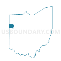
Outline

Summary
| Unique Area Identifier | 652921 |
| Name | PRECINCT UNION |
| County | Van Wert County |
| State | Ohio |
| Area (square miles) | 36.49 |
| Land Area (square miles) | 36.43 |
| Water Area (square miles) | 0.06 |
| % of Land Area | 99.84 |
| % of Water Area | 0.16 |
| Latitude of the Internal Point | 40.94269290 |
| Longtitude of the Internal Point | -84.63960450 |
Maps


Graphs
Select a template below for downloading or customizing gragh for PRECINCT UNION, Van Wert County, Ohio


Neighbors
Neighoring Voting District (by Name) Neighboring Voting District on the Map
- Voting District BENTON TWP, Paulding County, OH
- Voting District BLUE CREEK TWP, Paulding County, OH
- Voting District LATTY TWP & GROVER HILL, Paulding County, OH
- PRECINCT HARRISON, Van Wert County, OH
- PRECINCT HOAGLIN, Van Wert County, OH
- PRECINCT PLEASANT NORTH, Van Wert County, OH
- PRECINCT RIDGE, Van Wert County, OH
- PRECINCT TULLY, Van Wert County, OH
Top 10 Neighboring County Subdivision (by Population) Neighboring County Subdivision on the Map
- Pleasant township, Van Wert County, OH (10,716)
- Ridge township, Van Wert County, OH (3,192)
- Tully township, Van Wert County, OH (2,054)
- Benton township, Paulding County, OH (1,046)
- Harrison township, Van Wert County, OH (1,039)
- Latty township, Paulding County, OH (1,017)
- Union township, Van Wert County, OH (942)
- Blue Creek township, Paulding County, OH (781)
- Hoaglin township, Van Wert County, OH (662)
Top 10 Neighboring Place (by Population) Neighboring Place on the Map
Top 10 Neighboring Unified School District (by Population) Neighboring Unified School District on the Map
- Van Wert City School District, OH (13,922)
- Wayne Trace Local School District, OH (5,645)
- Crestview Local School District, OH (4,633)
- Lincolnview Local School District, OH (4,267)
Top 10 Neighboring State Legislative District Lower Chamber (by Population) Neighboring State Legislative District Lower Chamber on the Map
Top 10 Neighboring State Legislative District Upper Chamber (by Population) Neighboring State Legislative District Upper Chamber on the Map
Top 10 Neighboring 111th Congressional District (by Population) Neighboring 111th Congressional District on the Map
Top 10 Neighboring Census Tract (by Population) Neighboring Census Tract on the Map
- Census Tract 202, Van Wert County, OH (4,516)
- Census Tract 201, Van Wert County, OH (4,286)
- Census Tract 9603, Paulding County, OH (4,219)
- Census Tract 9605, Paulding County, OH (3,833)
- Census Tract 203, Van Wert County, OH (2,623)