


PRECINCT UNION TWP. WEST, Putnam County, Ohio
About
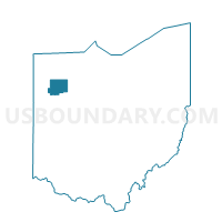
Outline

Summary
| Unique Area Identifier | 651237 |
| Name | PRECINCT UNION TWP. WEST |
| County | Putnam County |
| State | Ohio |
| Area (square miles) | 11.93 |
| Land Area (square miles) | 11.87 |
| Water Area (square miles) | 0.06 |
| % of Land Area | 99.53 |
| % of Water Area | 0.47 |
| Latitude of the Internal Point | 40.96069680 |
| Longtitude of the Internal Point | -84.20032000 |
Maps


Graphs
Select a template below for downloading or customizing gragh for PRECINCT UNION TWP. WEST, Putnam County, Ohio


Neighbors
Neighoring Voting District (by Name) Neighboring Voting District on the Map
- PRECINCT GREENSBURG TWP., Putnam County, OH
- PRECINCT JACKSON TWP., Putnam County, OH
- PRECINCT JENNINGS TWP. EAST, Putnam County, OH
- PRECINCT KALIDA CORP., Putnam County, OH
- PRECINCT PERRY TWP., Putnam County, OH
- PRECINCT SUGAR CREEK TWP., Putnam County, OH
- PRECINCT UNION TWP. EAST, Putnam County, OH
Top 10 Neighboring County Subdivision (by Population) Neighboring County Subdivision on the Map
- Union township, Putnam County, OH (3,052)
- Jennings township, Putnam County, OH (1,978)
- Greensburg township, Putnam County, OH (1,397)
- Sugar Creek township, Putnam County, OH (1,200)
- Perry township, Putnam County, OH (1,166)
- Jackson township, Putnam County, OH (934)
Top 10 Neighboring Place (by Population) Neighboring Place on the Map
Top 10 Neighboring Unified School District (by Population) Neighboring Unified School District on the Map
- Ottawa-Glandorf Local School District, OH (8,954)
- Columbus Grove Local School District, OH (5,146)
- Continental Local School District, OH (3,623)
- Kalida Local School District, OH (3,570)
- Jennings Local School District, OH (1,925)
Top 10 Neighboring State Legislative District Lower Chamber (by Population) Neighboring State Legislative District Lower Chamber on the Map
Top 10 Neighboring State Legislative District Upper Chamber (by Population) Neighboring State Legislative District Upper Chamber on the Map
Top 10 Neighboring 111th Congressional District (by Population) Neighboring 111th Congressional District on the Map
Top 10 Neighboring Census Tract (by Population) Neighboring Census Tract on the Map
- Census Tract 302, Putnam County, OH (5,823)
- Census Tract 307, Putnam County, OH (4,980)
- Census Tract 306, Putnam County, OH (4,252)