


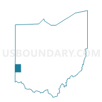
PRECINCT WEST ALEXANDRIA NORTH, Preble County, Ohio
About
Outline

Summary
| Unique Area Identifier | 651173 |
| Name | PRECINCT WEST ALEXANDRIA NORTH |
| County | Preble County |
| State | Ohio |
| Area (square miles) | 0.22 |
| Land Area (square miles) | 0.22 |
| Water Area (square miles) | 0.00 |
| % of Land Area | 100.00 |
| % of Water Area | 0.00 |
| Latitude of the Internal Point | 39.74706600 |
| Longtitude of the Internal Point | -84.53183350 |
Maps


Graphs
Select a template below for downloading or customizing gragh for PRECINCT WEST ALEXANDRIA NORTH, Preble County, Ohio


Neighbors
Neighoring Voting District (by Name) Neighboring Voting District on the Map
- PRECINCT TWIN EAST, Preble County, OH
- PRECINCT TWIN WEST, Preble County, OH
- PRECINCT WEST ALEXANDRIA SOUTH, Preble County, OH