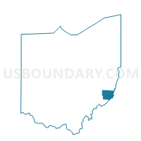
PRECINCT CLARINGTON, Monroe County, Ohio
About
Outline

Summary
| Unique Area Identifier | 650124 |
| Name | PRECINCT CLARINGTON |
| County | Monroe County |
| State | Ohio |
| Area (square miles) | 1.24 |
| Land Area (square miles) | 1.14 |
| Water Area (square miles) | 0.10 |
| % of Land Area | 92.03 |
| % of Water Area | 7.97 |
| Latitude of the Internal Point | 39.77623230 |
| Longtitude of the Internal Point | -80.86839620 |
Maps


Graphs
Select a template below for downloading or customizing gragh for PRECINCT CLARINGTON, Monroe County, Ohio