


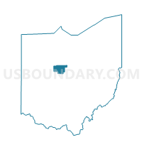
PRECINCT SCOTT TWP, Marion County, Ohio
About
Outline

Summary
| Unique Area Identifier | 649786 |
| Name | PRECINCT SCOTT TWP |
| County | Marion County |
| State | Ohio |
| Area (square miles) | 24.43 |
| Land Area (square miles) | 24.43 |
| Water Area (square miles) | 0.00 |
| % of Land Area | 100.00 |
| % of Water Area | 0.00 |
| Latitude of the Internal Point | 40.67403910 |
| Longtitude of the Internal Point | -83.01552600 |
Maps


Graphs
Select a template below for downloading or customizing gragh for PRECINCT SCOTT TWP, Marion County, Ohio


Neighbors
Neighoring Voting District (by Name) Neighboring Voting District on the Map
- CANAAN TWP, Morrow County, OH
- Voting District Dallas Twp, Crawford County, OH
- PRECINCT CLARIDON TWP A, Marion County, OH
- PRECINCT CLARIDON TWP B, Marion County, OH
- PRECINCT GRAND PRAIRIE B, Marion County, OH
- PRECINCT GRAND PRAIRIE C, Marion County, OH
- PRECINCT MARION TWP H, Marion County, OH
- PRECINCT TULLY TOWNSHIP, Marion County, OH
- Voting District Whetstone Twp South, Crawford County, OH
Top 10 Neighboring County Subdivision (by Population) Neighboring County Subdivision on the Map
- Marion township, Marion County, OH (44,749)
- Claridon township, Marion County, OH (2,742)
- Whetstone township, Crawford County, OH (2,080)
- Grand Prairie township, Marion County, OH (1,590)
- Canaan township, Morrow County, OH (963)
- Tully township, Marion County, OH (854)
- Scott township, Marion County, OH (498)
- Dallas township, Crawford County, OH (485)
Top 10 Neighboring Unified School District (by Population) Neighboring Unified School District on the Map
- River Valley Local School District, OH (16,332)
- Wynford Local School District, OH (6,493)
- Colonel Crawford Local School District, OH (5,727)
- Ridgedale Local School District, OH (4,603)
Top 10 Neighboring State Legislative District Lower Chamber (by Population) Neighboring State Legislative District Lower Chamber on the Map
- State House District 90, OH (126,807)
- State House District 83, OH (119,433)
- State House District 82, OH (111,625)
Top 10 Neighboring State Legislative District Upper Chamber (by Population) Neighboring State Legislative District Upper Chamber on the Map
Top 10 Neighboring 111th Congressional District (by Population) Neighboring 111th Congressional District on the Map
Top 10 Neighboring Census Tract (by Population) Neighboring Census Tract on the Map
- Census Tract 9652, Morrow County, OH (7,089)
- Census Tract 102.01, Marion County, OH (5,231)
- Census Tract 101, Marion County, OH (5,181)
- Census Tract 9742, Crawford County, OH (4,345)