


PRECINCT WELLSTON 4-A, Jackson County, Ohio
About
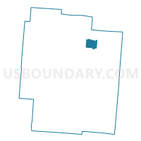
Outline

Summary
| Unique Area Identifier | 648071 |
| Name | PRECINCT WELLSTON 4-A |
| County | Jackson County |
| State | Ohio |
| Area (square miles) | 3.16 |
| Land Area (square miles) | 3.11 |
| Water Area (square miles) | 0.06 |
| % of Land Area | 98.23 |
| % of Water Area | 1.77 |
| Latitude of the Internal Point | 39.10063730 |
| Longtitude of the Internal Point | -82.54377330 |
Maps


Graphs
Select a template below for downloading or customizing gragh for PRECINCT WELLSTON 4-A, Jackson County, Ohio


Neighbors
Neighoring Voting District (by Name) Neighboring Voting District on the Map
- PRECINCT COAL 2, Jackson County, OH
- PRECINCT MILTON, Jackson County, OH
- PRECINCT WELLSTON 2-A, Jackson County, OH
- PRECINCT WELLSTON 2-B, Jackson County, OH
- PRECINCT WELLSTON 3-A, Jackson County, OH
Top 10 Neighboring County Subdivision (by Population) Neighboring County Subdivision on the Map
- Wellston city, Jackson County, OH (5,663)
- Coal township, Jackson County, OH (1,974)
- Milton township, Jackson County, OH (1,028)