


Voting District MONROE NORTH, Henry County, Ohio
About
Outline

Summary
| Unique Area Identifier | 647908 |
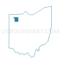
| Name | Voting District MONROE NORTH |
| County | Henry County |
| State | Ohio |
| Area (square miles) | 12.24 |
| Land Area (square miles) | 12.24 |
| Water Area (square miles) | 0.00 |
| % of Land Area | 100.00 |
| % of Water Area | 0.00 |
| Latitude of the Internal Point | 41.32688320 |
| Longtitude of the Internal Point | -84.05734700 |
Maps


Graphs
Select a template below for downloading or customizing gragh for Voting District MONROE NORTH, Henry County, Ohio


Neighbors
Neighoring Voting District (by Name) Neighboring Voting District on the Map
- Voting District DAMASCUS, Henry County, OH
- Voting District FLATROCK SOUTH, Henry County, OH
- Voting District HARRISON, Henry County, OH
- Voting District MONROE SOUTH, Henry County, OH
- Voting District NAPOLEON EAST, Henry County, OH
- Voting District RICHFIELD, Henry County, OH
Top 10 Neighboring County Subdivision (by Population) Neighboring County Subdivision on the Map
- Napoleon township, Henry County, OH (9,796)
- Damascus township, Henry County, OH (1,801)
- Harrison township, Henry County, OH (1,327)
- Flatrock township, Henry County, OH (1,247)
- Monroe township, Henry County, OH (1,142)
- Richfield township, Henry County, OH (682)