


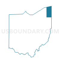
Pierpont Voting District, Ashtabula County, Ohio
About
Outline

Summary
| Unique Area Identifier | 642659 |
| Name | Pierpont Voting District |
| County | Ashtabula County |
| State | Ohio |
| Area (square miles) | 28.07 |
| Land Area (square miles) | 28.06 |
| Water Area (square miles) | 0.01 |
| % of Land Area | 99.97 |
| % of Water Area | 0.03 |
| Latitude of the Internal Point | 41.75385030 |
| Longtitude of the Internal Point | -80.57113980 |
Maps


Graphs
Select a template below for downloading or customizing gragh for Pierpont Voting District, Ashtabula County, Ohio


Neighbors
Neighoring Voting District (by Name) Neighboring Voting District on the Map
- BEAVER TWP Voting District, Crawford County, PA
- CONNEAUT TWP Voting District, Crawford County, PA
- Denmark Voting District, Ashtabula County, OH
- Dorset Voting District, Ashtabula County, OH
- Monroe 1 Voting District, Ashtabula County, OH
- Monroe 2 Voting District, Ashtabula County, OH
- Richmond Voting District, Ashtabula County, OH
- Sheff 2 Voting District, Ashtabula County, OH
Top 10 Neighboring County Subdivision (by Population) Neighboring County Subdivision on the Map
- Monroe township, Ashtabula County, OH (2,381)
- Sheffield township, Ashtabula County, OH (1,639)
- Conneaut township, Crawford County, PA (1,476)
- Pierpont township, Ashtabula County, OH (1,285)
- Denmark township, Ashtabula County, OH (946)
- Richmond township, Ashtabula County, OH (938)
- Beaver township, Crawford County, PA (902)
- Dorset township, Ashtabula County, OH (846)
Top 10 Neighboring Unified School District (by Population) Neighboring Unified School District on the Map
- Conneaut School District, PA (18,617)
- Conneaut Area City School District, OH (14,670)
- Buckeye Local School District, OH (12,625)
- Jefferson Area Local School District, OH (11,576)
- Pymatuning Valley Local School District, OH (7,977)
Top 10 Neighboring State Legislative District Lower Chamber (by Population) Neighboring State Legislative District Lower Chamber on the Map
Top 10 Neighboring State Legislative District Upper Chamber (by Population) Neighboring State Legislative District Upper Chamber on the Map
Top 10 Neighboring 111th Congressional District (by Population) Neighboring 111th Congressional District on the Map
Top 10 Neighboring Census Tract (by Population) Neighboring Census Tract on the Map
- Census Tract 12, Ashtabula County, OH (7,482)
- Census Tract 1103, Crawford County, PA (4,920)
- Census Tract 13.02, Ashtabula County, OH (3,896)
- Census Tract 1104, Crawford County, PA (2,978)
Top 10 Neighboring 5-Digit ZIP Code Tabulation Area (by Population) Neighboring 5-Digit ZIP Code Tabulation Area on the Map
- 44047, OH (9,213)
- 16424, PA (4,676)
- 44003, OH (4,676)
- 16406, PA (3,509)
- 44048, OH (2,565)
- 44082, OH (1,619)
- 44032, OH (1,557)