


Colebrook Voting District, Ashtabula County, Ohio
About
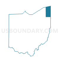
Outline

Summary
| Unique Area Identifier | 642658 |
| Name | Colebrook Voting District |
| County | Ashtabula County |
| State | Ohio |
| Area (square miles) | 24.61 |
| Land Area (square miles) | 24.51 |
| Water Area (square miles) | 0.10 |
| % of Land Area | 99.58 |
| % of Water Area | 0.42 |
| Latitude of the Internal Point | 41.52524660 |
| Longtitude of the Internal Point | -80.74640260 |
Maps


Graphs
Select a template below for downloading or customizing gragh for Colebrook Voting District, Ashtabula County, Ohio


Neighbors
Neighoring Voting District (by Name) Neighboring Voting District on the Map
- BLOOMFIELD TWP Voting District, Trumbull County, OH
- Cherry Valley Voting District, Ashtabula County, OH
- GREENE TWP Voting District, Trumbull County, OH
- GUSTAVUS TWP Voting District, Trumbull County, OH
- New Lyme Voting District, Ashtabula County, OH
- Orwell Twp Voting District, Ashtabula County, OH
- Rome Voting District, Ashtabula County, OH
- Wayne Voting District, Ashtabula County, OH
Top 10 Neighboring County Subdivision (by Population) Neighboring County Subdivision on the Map
- Orwell township, Ashtabula County, OH (3,106)
- Rome township, Ashtabula County, OH (1,812)
- Bloomfield township, Trumbull County, OH (1,322)
- New Lyme township, Ashtabula County, OH (1,116)
- Greene township, Trumbull County, OH (1,015)
- Colebrook township, Ashtabula County, OH (994)
- Gustavus township, Trumbull County, OH (829)
- Wayne township, Ashtabula County, OH (630)
Top 10 Neighboring Unified School District (by Population) Neighboring Unified School District on the Map
- Grand Valley Local School District, OH (9,531)
- Pymatuning Valley Local School District, OH (7,977)
- Joseph Badger Local School District, OH (6,508)
- Maplewood Local School District, OH (5,696)
- Bloomfield-Mespo Local School District, OH (4,429)
Top 10 Neighboring State Legislative District Lower Chamber (by Population) Neighboring State Legislative District Lower Chamber on the Map
Top 10 Neighboring State Legislative District Upper Chamber (by Population) Neighboring State Legislative District Upper Chamber on the Map
Top 10 Neighboring 111th Congressional District (by Population) Neighboring 111th Congressional District on the Map
Top 10 Neighboring Census Tract (by Population) Neighboring Census Tract on the Map
- Census Tract 14, Ashtabula County, OH (8,256)
- Census Tract 9304, Trumbull County, OH (4,241)
- Census Tract 13.01, Ashtabula County, OH (3,927)
- Census Tract 9303, Trumbull County, OH (3,689)
- Census Tract 9302, Trumbull County, OH (2,743)
Top 10 Neighboring 5-Digit ZIP Code Tabulation Area (by Population) Neighboring 5-Digit ZIP Code Tabulation Area on the Map
- 44047, OH (9,213)
- 44076, OH (5,141)
- 44085, OH (3,277)
- 44450, OH (2,042)
- 44417, OH (1,659)
- 44093, OH (1,467)