


Golden Valley Precinct 1, Golden Valley County, North Dakota
About
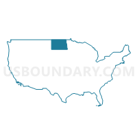
Outline

Summary
| Unique Area Identifier | 642073 |
| Name | Golden Valley Precinct 1 |
| County | Golden Valley County |
| State | North Dakota |
| Area (square miles) | 1,002.39 |
| Land Area (square miles) | 1,000.79 |
| Water Area (square miles) | 1.60 |
| % of Land Area | 99.84 |
| % of Water Area | 0.16 |
| Latitude of the Internal Point | 46.93892370 |
| Longtitude of the Internal Point | -103.84461170 |
Maps


Graphs
Select a template below for downloading or customizing gragh for Golden Valley Precinct 1, Golden Valley County, North Dakota


Neighbors
Neighoring Voting District (by Name) Neighboring Voting District on the Map
- Billings 39-01 Voting District, Billings County, ND
- McKenzie 39-06 Voting District, McKenzie County, ND
- Precinct 1, Wibaux County, MT
- Precinct 3, Fallon County, MT
- Slope 39-03 Voting District, Slope County, ND
Top 10 Neighboring County Subdivision (by Population) Neighboring County Subdivision on the Map
- Baker CCD, Fallon County, MT (2,522)
- Beach city, Golden Valley County, ND (1,019)
- Wibaux CCD, Wibaux County, MT (821)
- North Billings UT, Billings County, ND (467)
- Southwest McKenzie UT, McKenzie County, ND (271)
- South Billings UT, Billings County, ND (204)
- Pine Hill-St. Phillips CCD, Wibaux County, MT (196)
- Beach township, Golden Valley County, ND (157)
- Lone Tree township, Golden Valley County, ND (126)
- Golva city, Golden Valley County, ND (61)
Top 10 Neighboring Place (by Population) Neighboring Place on the Map
Top 10 Neighboring Elementary School District (by Population) Neighboring Elementary School District on the Map
- Billings County Public School District 1, ND (783)
- Lonetree Public School District 6, ND (240)
- Marmarth Public School District 12, ND (211)
- Central Elementary Public School District 32, ND (179)
- Earl Public School District 18, ND (85)
Top 10 Neighboring Unified School District (by Population) Neighboring Unified School District on the Map
- McKenzie County Public School District 1, ND (3,724)
- Baker K-12 Schools, MT (2,470)
- Beach Public School District 3, ND (1,440)
- Wibaux K-12 Schools, MT (1,017)
Top 10 Neighboring State Legislative District Lower Chamber (by Population) Neighboring State Legislative District Lower Chamber on the Map
- State House District 39, ND (13,645)
- State House District 38, MT (9,122)
- State House District 39, MT (8,893)
Top 10 Neighboring State Legislative District Upper Chamber (by Population) Neighboring State Legislative District Upper Chamber on the Map
- State Senate District 19, MT (18,732)
- State Senate District 20, MT (18,169)
- State Senate District 39, ND (13,645)
Top 10 Neighboring 111th Congressional District (by Population) Neighboring 111th Congressional District on the Map
Top 10 Neighboring Census Tract (by Population) Neighboring Census Tract on the Map
- Census Tract 1, Fallon County, MT (2,890)
- Census Tract 9629, Golden Valley County, ND (1,680)
- Census Tract 9625, McKenzie County, ND (1,308)
- Census Tract 1, Wibaux County, MT (1,017)
- Census Tract 9631, Billings County, ND (783)
- Census Tract 9650, Slope County, ND (727)
Top 10 Neighboring 5-Digit ZIP Code Tabulation Area (by Population) Neighboring 5-Digit ZIP Code Tabulation Area on the Map
- 59270, MT (7,339)
- 59313, MT (2,498)
- 58621, ND (1,231)
- 59353, MT (1,017)
- 58651, ND (475)
- 58654, ND (289)
- 58645, ND (238)
- 58643, ND (191)
- 58632, ND (149)