


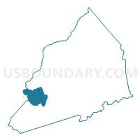
Voting District LT, Transylvania County, North Carolina
About
Outline

Summary
| Unique Area Identifier | 641497 |
| Name | Voting District LT |
| County | Transylvania County |
| State | North Carolina |
| Area (square miles) | 13.34 |
| Land Area (square miles) | 12.51 |
| Water Area (square miles) | 0.83 |
| % of Land Area | 93.79 |
| % of Water Area | 6.21 |
| Latitude of the Internal Point | 35.13149200 |
| Longtitude of the Internal Point | -82.94349280 |
Maps


Graphs
Select a template below for downloading or customizing gragh for Voting District LT, Transylvania County, North Carolina


Neighbors
Neighoring Voting District (by Name) Neighboring Voting District on the Map
- Voting District CAN, Jackson County, NC
- Voting District GL, Transylvania County, NC
- Voting District QB, Transylvania County, NC
- Voting District SW, Transylvania County, NC
Top 10 Neighboring County Subdivision (by Population) Neighboring County Subdivision on the Map
- Hogback township, Transylvania County, NC (2,215)
- Gloucester township, Transylvania County, NC (1,326)
- Canada township, Jackson County, NC (640)