


Voting District UH08, Pender County, North Carolina
About
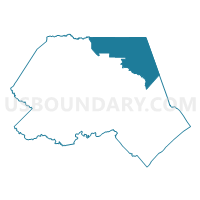
Outline

Summary
| Unique Area Identifier | 641126 |
| Name | Voting District UH08 |
| County | Pender County |
| State | North Carolina |
| Area (square miles) | 104.98 |
| Land Area (square miles) | 104.86 |
| Water Area (square miles) | 0.12 |
| % of Land Area | 99.88 |
| % of Water Area | 0.12 |
| Latitude of the Internal Point | 34.64987160 |
| Longtitude of the Internal Point | -77.75066460 |
Maps


Graphs
Select a template below for downloading or customizing gragh for Voting District UH08, Pender County, North Carolina


Neighbors
Neighoring Voting District (by Name) Neighboring Voting District on the Map
- Voting District CYRK, Duplin County, NC
- Voting District HN14, Onslow County, NC
- Voting District HR17, Onslow County, NC
- Voting District LU16, Pender County, NC
- Voting District MH07, Pender County, NC
- Voting District NM13, Onslow County, NC
- Voting District SP15, Pender County, NC
- Voting District UU17, Pender County, NC
- Voting District WALL, Duplin County, NC
Top 10 Neighboring County Subdivision (by Population) Neighboring County Subdivision on the Map
- Jacksonville township, Onslow County, NC (70,537)
- Topsail township, Pender County, NC (21,253)
- Stump Sound township, Onslow County, NC (17,336)
- Island Creek township, Duplin County, NC (10,390)
- Union township, Pender County, NC (4,232)
- Cypress Creek township, Duplin County, NC (3,409)
- Holly township, Pender County, NC (2,360)
Top 10 Neighboring Unified School District (by Population) Neighboring Unified School District on the Map
- Onslow County Schools, NC (148,667)
- Duplin County Schools, NC (58,505)
- Pender County Schools, NC (52,217)
Top 10 Neighboring State Legislative District Lower Chamber (by Population) Neighboring State Legislative District Lower Chamber on the Map
- State House District 16, NC (93,684)
- State House District 4, NC (82,523)
- State House District 15, NC (69,750)
Top 10 Neighboring State Legislative District Upper Chamber (by Population) Neighboring State Legislative District Upper Chamber on the Map
- State Senate District 8, NC (217,746)
- State Senate District 6, NC (187,925)
- State Senate District 10, NC (181,431)
Top 10 Neighboring 111th Congressional District (by Population) Neighboring 111th Congressional District on the Map
Top 10 Neighboring Census Tract (by Population) Neighboring Census Tract on the Map
- Census Tract 3.02, Onslow County, NC (9,027)
- Census Tract 3.01, Onslow County, NC (5,981)
- Census Tract 4.01, Onslow County, NC (4,787)
- Census Tract 9203, Pender County, NC (4,232)
- Census Tract 907.01, Duplin County, NC (3,933)
- Census Tract 906, Duplin County, NC (3,541)
- Census Tract 9202.04, Pender County, NC (2,231)
Top 10 Neighboring 5-Digit ZIP Code Tabulation Area (by Population) Neighboring 5-Digit ZIP Code Tabulation Area on the Map
- 28443, NC (17,512)
- 28425, NC (10,906)
- 28466, NC (10,103)
- 28445, NC (5,676)
- 28478, NC (4,588)
- 28454, NC (2,545)