


Voting District CT03, Pender County, North Carolina
About
Outline

Summary
| Unique Area Identifier | 641113 |
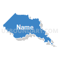
| Name | Voting District CT03 |
| County | Pender County |
| State | North Carolina |
| Area (square miles) | 45.67 |
| Land Area (square miles) | 44.19 |
| Water Area (square miles) | 1.48 |
| % of Land Area | 96.76 |
| % of Water Area | 3.24 |
| Latitude of the Internal Point | 34.39183510 |
| Longtitude of the Internal Point | -78.15512050 |
Maps


Graphs
Select a template below for downloading or customizing gragh for Voting District CT03, Pender County, North Carolina


Neighbors
Neighoring Voting District (by Name) Neighboring Voting District on the Map
- Voting District 01, Brunswick County, NC
- Voting District 02, Brunswick County, NC
- Voting District CS04, Pender County, NC
- Voting District GR06, Pender County, NC
- Voting District P14, Columbus County, NC
- Voting District P30, Bladen County, NC
- Voting District P55, Bladen County, NC
Top 10 Neighboring County Subdivision (by Population) Neighboring County Subdivision on the Map
- Northwest township, Brunswick County, NC (12,190)
- Ransom township, Columbus County, NC (4,809)
- Grady township, Pender County, NC (2,368)
- Carvers Creek township, Bladen County, NC (1,884)
- Caswell township, Pender County, NC (1,418)
- Frenches Creek township, Bladen County, NC (1,035)
- Canetuck township, Pender County, NC (370)
Top 10 Neighboring Unified School District (by Population) Neighboring Unified School District on the Map
- Brunswick County Schools, NC (107,431)
- Pender County Schools, NC (52,217)
- Columbus County Schools, NC (43,225)
- Bladen County Schools, NC (35,190)
Top 10 Neighboring State Legislative District Lower Chamber (by Population) Neighboring State Legislative District Lower Chamber on the Map
- State House District 17, NC (94,557)
- State House District 16, NC (93,684)
- State House District 22, NC (83,941)
- State House District 20, NC (70,972)
Top 10 Neighboring State Legislative District Upper Chamber (by Population) Neighboring State Legislative District Upper Chamber on the Map
Top 10 Neighboring 111th Congressional District (by Population) Neighboring 111th Congressional District on the Map
Top 10 Neighboring Census Tract (by Population) Neighboring Census Tract on the Map
- Census Tract 9506, Bladen County, NC (6,453)
- Census Tract 9501, Bladen County, NC (5,693)
- Census Tract 9205.01, Pender County, NC (4,633)
- Census Tract 9301, Columbus County, NC (4,198)
- Census Tract 201.01, Brunswick County, NC (2,706)
- Census Tract 9205.02, Pender County, NC (1,717)